You are here: Home > Network List > GS - US Geological Survey Networks Stations List
> Station KAN13 Rinehart Farm > Earthquake Result Viewer
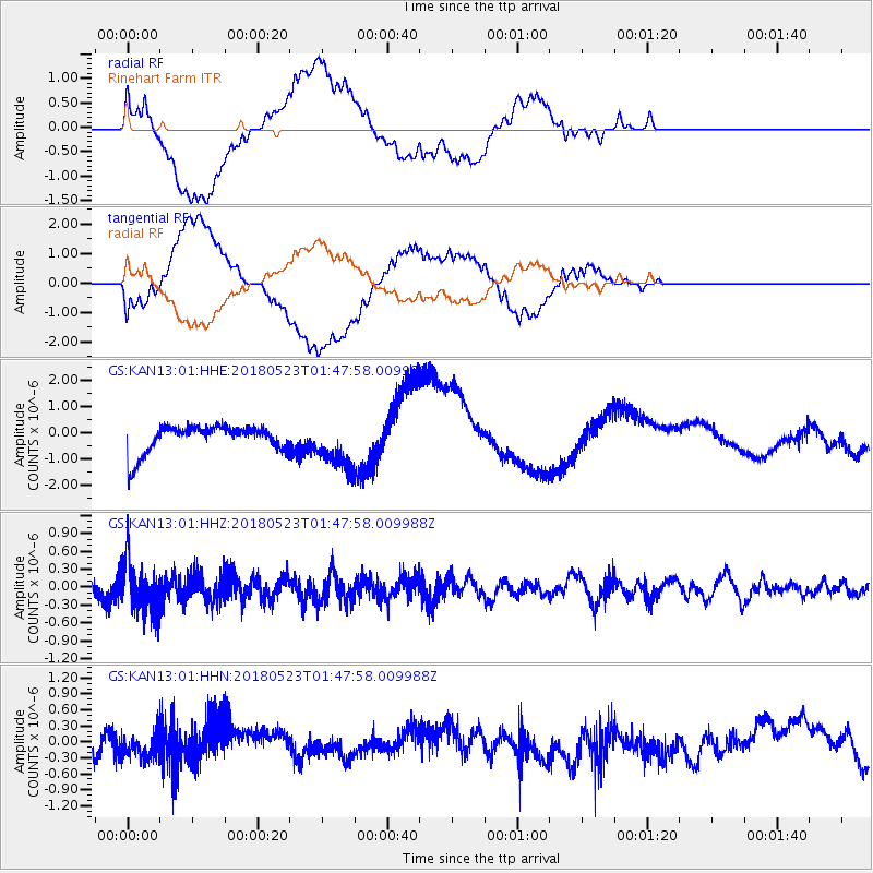
KAN13 Rinehart Farm - Earthquake Result Viewer
*The percent match for this event was below the threshold and hence no stack was calculated.
| Earthquake location: |
Near East Coast Of Kamchatka |
| Earthquake latitude/longitude: |
55.3/161.9 |
| Earthquake time(UTC): |
2018/05/23 (143) 01:37:48 GMT |
| Earthquake Depth: |
59 km |
| Earthquake Magnitude: |
5.4 Mww |
| Earthquake Catalog/Contributor: |
NEIC PDE/us |
|
| Network: |
GS US Geological Survey Networks |
| Station: |
KAN13 Rinehart Farm |
| Lat/Lon: |
37.01 N/97.48 W |
| Elevation: |
340 m |
|
| Distance: |
66.0 deg |
| Az: |
59.479 deg |
| Baz: |
321.982 deg |
| Ray Param: |
$rayparam |
*The percent match for this event was below the threshold and hence was not used in the summary stack. |
|
| Radial Match: |
57.139923 % |
| Radial Bump: |
400 |
| Transverse Match: |
55.265533 % |
| Transverse Bump: |
400 |
| SOD ConfigId: |
2665671 |
| Insert Time: |
2018-06-06 01:41:01.436 +0000 |
| GWidth: |
2.5 |
| Max Bumps: |
400 |
| Tol: |
0.001 |
|
Signal To Noise
| Channel | StoN | STA | LTA |
| GS:KAN13:01:HHZ:20180523T01:47:58.009988Z | 2.5190432 | 4.3509644E-7 | 1.727229E-7 |
| GS:KAN13:01:HHN:20180523T01:47:58.009988Z | 1.1345476 | 2.2623966E-7 | 1.994096E-7 |
| GS:KAN13:01:HHE:20180523T01:47:58.009988Z | 1.7041494 | 9.077168E-7 | 5.32651E-7 |
| Arrivals |
| Ps | |
| PpPs | |
| PsPs/PpSs | |


