You are here: Home > Network List > US - United States National Seismic Network Stations List
> Station AMTX Amarillo, Texas, USA > Earthquake Result Viewer
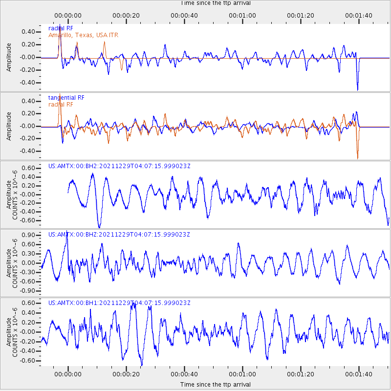
AMTX Amarillo, Texas, USA - Earthquake Result Viewer
*The percent match for this event was below the threshold and hence no stack was calculated.
| Earthquake location: |
Near Islands, Aleutian Islands |
| Earthquake latitude/longitude: |
54.7/170.6 |
| Earthquake time(UTC): |
2021/12/29 (363) 03:57:35 GMT |
| Earthquake Depth: |
26 km |
| Earthquake Magnitude: |
5.6 Mi |
| Earthquake Catalog/Contributor: |
NEIC PDE/at |
|
| Network: |
US United States National Seismic Network |
| Station: |
AMTX Amarillo, Texas, USA |
| Lat/Lon: |
34.53 N/101.41 W |
| Elevation: |
1010 m |
|
| Distance: |
61.5 deg |
| Az: |
69.795 deg |
| Baz: |
318.68 deg |
| Ray Param: |
$rayparam |
*The percent match for this event was below the threshold and hence was not used in the summary stack. |
|
| Radial Match: |
49.503265 % |
| Radial Bump: |
400 |
| Transverse Match: |
59.008266 % |
| Transverse Bump: |
398 |
| SOD ConfigId: |
26694651 |
| Insert Time: |
2022-01-12 04:19:46.209 +0000 |
| GWidth: |
2.5 |
| Max Bumps: |
400 |
| Tol: |
0.001 |
|
Signal To Noise
| Channel | StoN | STA | LTA |
| US:AMTX:00:BHZ:20211229T04:07:15.999023Z | 1.4034356 | 3.701671E-7 | 2.637578E-7 |
| US:AMTX:00:BH1:20211229T04:07:15.999023Z | 0.723538 | 1.85493E-7 | 2.563694E-7 |
| US:AMTX:00:BH2:20211229T04:07:15.999023Z | 0.8381623 | 2.2059076E-7 | 2.631838E-7 |
| Arrivals |
| Ps | |
| PpPs | |
| PsPs/PpSs | |


