You are here: Home > Network List > US - United States National Seismic Network Stations List
> Station MNTX Cornudas Mountains, Texas, USA > Earthquake Result Viewer
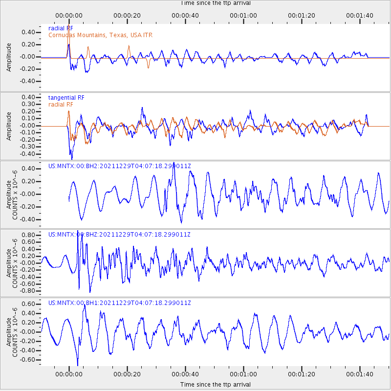
MNTX Cornudas Mountains, Texas, USA - Earthquake Result Viewer
*The percent match for this event was below the threshold and hence no stack was calculated.
| Earthquake location: |
Near Islands, Aleutian Islands |
| Earthquake latitude/longitude: |
54.7/170.6 |
| Earthquake time(UTC): |
2021/12/29 (363) 03:57:35 GMT |
| Earthquake Depth: |
26 km |
| Earthquake Magnitude: |
5.6 Mi |
| Earthquake Catalog/Contributor: |
NEIC PDE/at |
|
| Network: |
US United States National Seismic Network |
| Station: |
MNTX Cornudas Mountains, Texas, USA |
| Lat/Lon: |
31.70 N/105.38 W |
| Elevation: |
405 m |
|
| Distance: |
61.5 deg |
| Az: |
74.766 deg |
| Baz: |
318.891 deg |
| Ray Param: |
$rayparam |
*The percent match for this event was below the threshold and hence was not used in the summary stack. |
|
| Radial Match: |
58.970207 % |
| Radial Bump: |
400 |
| Transverse Match: |
80.6581 % |
| Transverse Bump: |
356 |
| SOD ConfigId: |
26694651 |
| Insert Time: |
2022-01-12 04:20:16.771 +0000 |
| GWidth: |
2.5 |
| Max Bumps: |
400 |
| Tol: |
0.001 |
|
Signal To Noise
| Channel | StoN | STA | LTA |
| US:MNTX:00:BHZ:20211229T04:07:18.299011Z | 3.3797114 | 3.763178E-7 | 1.1134613E-7 |
| US:MNTX:00:BH1:20211229T04:07:18.299011Z | 2.018837 | 2.944974E-7 | 1.4587478E-7 |
| US:MNTX:00:BH2:20211229T04:07:18.299011Z | 1.3762053 | 2.172014E-7 | 1.578263E-7 |
| Arrivals |
| Ps | |
| PpPs | |
| PsPs/PpSs | |


