You are here: Home > Network List > US - United States National Seismic Network Stations List
> Station MSO Missoula, Montana, USA > Earthquake Result Viewer
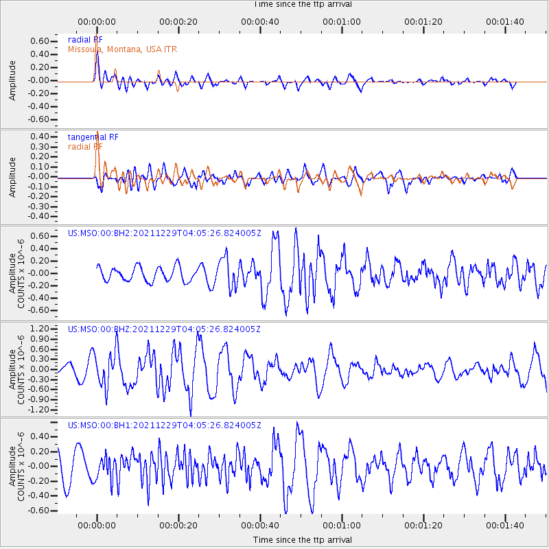
MSO Missoula, Montana, USA - Earthquake Result Viewer
*The percent match for this event was below the threshold and hence no stack was calculated.
| Earthquake location: |
Near Islands, Aleutian Islands |
| Earthquake latitude/longitude: |
54.7/170.6 |
| Earthquake time(UTC): |
2021/12/29 (363) 03:57:35 GMT |
| Earthquake Depth: |
26 km |
| Earthquake Magnitude: |
5.6 Mi |
| Earthquake Catalog/Contributor: |
NEIC PDE/at |
|
| Network: |
US United States National Seismic Network |
| Station: |
MSO Missoula, Montana, USA |
| Lat/Lon: |
46.83 N/113.94 W |
| Elevation: |
1264 m |
|
| Distance: |
46.2 deg |
| Az: |
67.039 deg |
| Baz: |
308.836 deg |
| Ray Param: |
$rayparam |
*The percent match for this event was below the threshold and hence was not used in the summary stack. |
|
| Radial Match: |
58.275387 % |
| Radial Bump: |
400 |
| Transverse Match: |
51.934002 % |
| Transverse Bump: |
400 |
| SOD ConfigId: |
26694651 |
| Insert Time: |
2022-01-12 04:20:17.317 +0000 |
| GWidth: |
2.5 |
| Max Bumps: |
400 |
| Tol: |
0.001 |
|
Signal To Noise
| Channel | StoN | STA | LTA |
| US:MSO:00:BHZ:20211229T04:05:26.824005Z | 4.579235 | 5.122658E-7 | 1.1186712E-7 |
| US:MSO:00:BH1:20211229T04:05:26.824005Z | 0.6977424 | 1.5220584E-7 | 2.1814046E-7 |
| US:MSO:00:BH2:20211229T04:05:26.824005Z | 2.0920331 | 2.366105E-7 | 1.1310074E-7 |
| Arrivals |
| Ps | |
| PpPs | |
| PsPs/PpSs | |


