You are here: Home > Network List > US - United States National Seismic Network Stations List
> Station OGNE Ogallala, Nebraska, USA > Earthquake Result Viewer
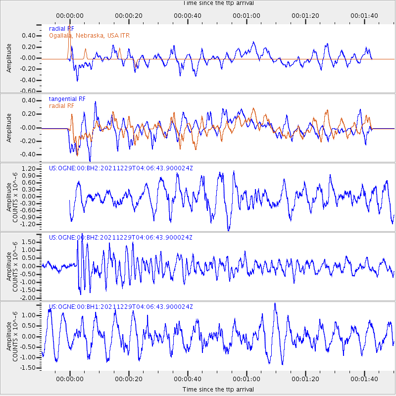
OGNE Ogallala, Nebraska, USA - Earthquake Result Viewer
*The percent match for this event was below the threshold and hence no stack was calculated.
| Earthquake location: |
Near Islands, Aleutian Islands |
| Earthquake latitude/longitude: |
54.7/170.6 |
| Earthquake time(UTC): |
2021/12/29 (363) 03:57:35 GMT |
| Earthquake Depth: |
26 km |
| Earthquake Magnitude: |
5.6 Mi |
| Earthquake Catalog/Contributor: |
NEIC PDE/at |
|
| Network: |
US United States National Seismic Network |
| Station: |
OGNE Ogallala, Nebraska, USA |
| Lat/Lon: |
40.95 N/102.03 W |
| Elevation: |
1054 m |
|
| Distance: |
56.5 deg |
| Az: |
65.155 deg |
| Baz: |
315.907 deg |
| Ray Param: |
$rayparam |
*The percent match for this event was below the threshold and hence was not used in the summary stack. |
|
| Radial Match: |
46.823772 % |
| Radial Bump: |
400 |
| Transverse Match: |
54.07791 % |
| Transverse Bump: |
400 |
| SOD ConfigId: |
26694651 |
| Insert Time: |
2022-01-12 04:20:21.336 +0000 |
| GWidth: |
2.5 |
| Max Bumps: |
400 |
| Tol: |
0.001 |
|
Signal To Noise
| Channel | StoN | STA | LTA |
| US:OGNE:00:BHZ:20211229T04:06:43.900024Z | 3.9862788 | 8.2081993E-7 | 2.0591132E-7 |
| US:OGNE:00:BH1:20211229T04:06:43.900024Z | 0.8215845 | 4.7579832E-7 | 5.7912274E-7 |
| US:OGNE:00:BH2:20211229T04:06:43.900024Z | 1.9696991 | 6.1691526E-7 | 3.1320278E-7 |
| Arrivals |
| Ps | |
| PpPs | |
| PsPs/PpSs | |


