THAK YL.THAK - Earthquake Result Viewer
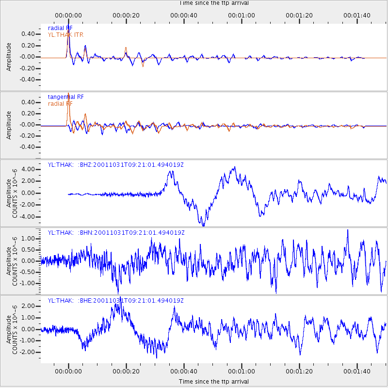
Earthquake location: New Britain Region, P.N.G.
Earthquake latitude/longitude: -5.9/150.2
Earthquake time(UTC): 2001/10/31 (304) 09:10:20 GMT
Earthquake Depth: 33 km
Earthquake Magnitude: 5.9 MB, 6.9 MS, 6.9 MW, 6.9 MW
Earthquake Catalog/Contributor: WHDF/NEIC
Network: YL Himalayan Nepal Tibet Experiment
Station: THAK YL.THAK
Lat/Lon: 27.60 N/85.56 E
Elevation: 1551 m
Distance: 70.7 deg
Az: 301.805 deg
Baz: 107.717 deg
Ray Param: 0.054777764
Estimated Moho Depth: 45.75 km
Estimated Crust Vp/Vs: 1.77
Assumed Crust Vp: 6.142 km/s
Estimated Crust Vs: 3.465 km/s
Estimated Crust Poisson's Ratio: 0.27
Radial Match: 93.81712 %
Radial Bump: 400
Transverse Match: 76.68972 %
Transverse Bump: 400
SOD ConfigId: 16820
Insert Time: 2010-02-26 16:16:12.084 +0000
GWidth: 2.5
Max Bumps: 400
Tol: 0.001

Signal To Noise

ChannelStoNSTALTA
YL:THAK: :BHN:20011031T09:21:01.494019Z2.67374972.3845323E-78.9183075E-8
YL:THAK: :BHE:20011031T09:21:01.494019Z4.73546654.6145422E-79.744642E-8
YL:THAK: :BHZ:20011031T09:21:01.494019Z12.5508691.3003627E-61.03607384E-7
Arrivals
Ps5.9 SECOND
PpPs20 SECOND
PsPs/PpSs26 SECOND