You are here: Home > Network List > AV - Alaska Volcano Observatory Stations List
> Station KAVE Katnai Ventifact, Alaska > Earthquake Result Viewer
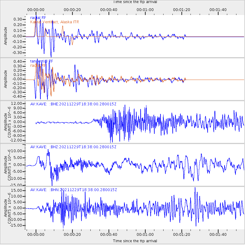
KAVE Katnai Ventifact, Alaska - Earthquake Result Viewer
*The percent match for this event was below the threshold and hence no stack was calculated.
| Earthquake location: |
Banda Sea |
| Earthquake latitude/longitude: |
-7.6/127.6 |
| Earthquake time(UTC): |
2021/12/29 (363) 18:25:51 GMT |
| Earthquake Depth: |
167 km |
| Earthquake Magnitude: |
7.3 mww |
| Earthquake Catalog/Contributor: |
NEIC PDE/us |
|
| Network: |
AV Alaska Volcano Observatory |
| Station: |
KAVE Katnai Ventifact, Alaska |
| Lat/Lon: |
58.20 N/155.02 W |
| Elevation: |
702 m |
|
| Distance: |
89.8 deg |
| Az: |
31.117 deg |
| Baz: |
255.344 deg |
| Ray Param: |
$rayparam |
*The percent match for this event was below the threshold and hence was not used in the summary stack. |
|
| Radial Match: |
84.69318 % |
| Radial Bump: |
400 |
| Transverse Match: |
78.60624 % |
| Transverse Bump: |
400 |
| SOD ConfigId: |
26694651 |
| Insert Time: |
2022-01-12 18:32:42.566 +0000 |
| GWidth: |
2.5 |
| Max Bumps: |
400 |
| Tol: |
0.001 |
|
Signal To Noise
| Channel | StoN | STA | LTA |
| AV:KAVE: :BHZ:20211229T18:38:00.280015Z | 20.485035 | 3.3641386E-6 | 1.642242E-7 |
| AV:KAVE: :BHN:20211229T18:38:00.280015Z | 4.4476886 | 1.2562087E-6 | 2.824408E-7 |
| AV:KAVE: :BHE:20211229T18:38:00.280015Z | 4.339944 | 1.1836892E-6 | 2.7274294E-7 |
| Arrivals |
| Ps | |
| PpPs | |
| PsPs/PpSs | |


