You are here: Home > Network List > GT - Global Telemetered Seismograph Network (USAF/USGS) Stations List
> Station LPAZ La Paz , Bolivia > Earthquake Result Viewer
LPAZ La Paz , Bolivia - Earthquake Result Viewer

| Earthquake location: |
South Sandwich Islands Region |
| Earthquake latitude/longitude: |
-55.9/-28.1 |
| Earthquake time(UTC): |
2021/12/30 (364) 04:58:15 GMT |
| Earthquake Depth: |
33 km |
| Earthquake Magnitude: |
5.8 Mww |
| Earthquake Catalog/Contributor: |
NEIC PDE/us |
|
| Network: |
GT Global Telemetered Seismograph Network (USAF/USGS) |
| Station: |
LPAZ La Paz , Bolivia |
| Lat/Lon: |
16.17 S/68.08 W |
| Elevation: |
4817 m |
|
| Distance: |
50.0 deg |
| Az: |
306.236 deg |
| Baz: |
151.789 deg |
| Ray Param: |
0.06831324 |
| Estimated Moho Depth: |
52.5 km |
| Estimated Crust Vp/Vs: |
1.87 |
| Assumed Crust Vp: |
6.454 km/s |
| Estimated Crust Vs: |
3.447 km/s |
| Estimated Crust Poisson's Ratio: |
0.30 |
|
| Radial Match: |
88.28891 % |
| Radial Bump: |
400 |
| Transverse Match: |
82.20391 % |
| Transverse Bump: |
400 |
| SOD ConfigId: |
26694651 |
| Insert Time: |
2022-01-13 05:01:39.229 +0000 |
| GWidth: |
2.5 |
| Max Bumps: |
400 |
| Tol: |
0.001 |
|
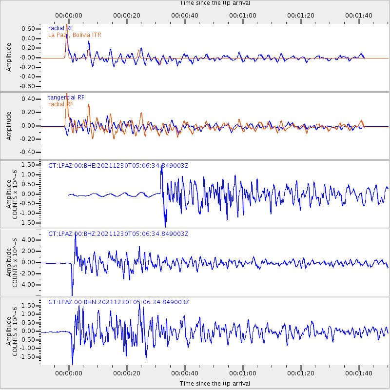
Signal To Noise
| Channel | StoN | STA | LTA |
| GT:LPAZ:00:BHZ:20211230T05:06:34.849003Z | 21.802929 | 1.9876825E-6 | 9.1165845E-8 |
| GT:LPAZ:00:BHN:20211230T05:06:34.849003Z | 16.202335 | 7.1045423E-7 | 4.3848882E-8 |
| GT:LPAZ:00:BHE:20211230T05:06:34.849003Z | 11.816537 | 6.948208E-7 | 5.880072E-8 |
| Arrivals |
| Ps | 7.5 SECOND |
| PpPs | 22 SECOND |
| PsPs/PpSs | 30 SECOND |


