
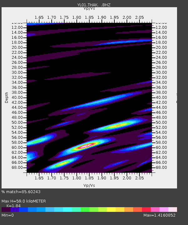
THAK YL.THAK - Earthquake Result Viewer
| ||||||||||||||||||
| ||||||||||||||||||
| ||||||||||||||||||
|
Signal To Noise
| Channel | StoN | STA | LTA |
| YL:THAK: :BHZ:20021001T08:58:47.476006Z | 1.2858717 | 8.564405E-8 | 6.660388E-8 |
| YL:THAK: :BHN:20021001T08:58:47.476006Z | 0.99055773 | 7.4421905E-8 | 7.513131E-8 |
| YL:THAK: :BHE:20021001T08:58:47.476006Z | 1.562586 | 1.0193805E-7 | 6.523676E-8 |
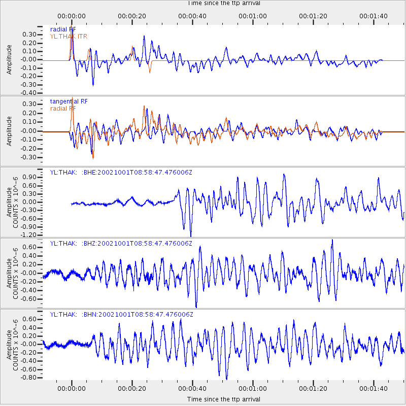
| Arrivals | |
| Ps | 8.3 SECOND |
| PpPs | 27 SECOND |
| PsPs/PpSs | 35 SECOND |

