You are here: Home > Network List > US - United States National Seismic Network Stations List
> Station LONY Lake Ozonia, New York, USA > Earthquake Result Viewer
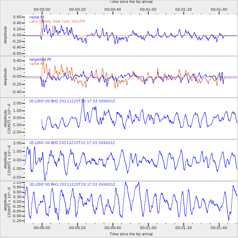
LONY Lake Ozonia, New York, USA - Earthquake Result Viewer
*The percent match for this event was below the threshold and hence no stack was calculated.
| Earthquake location: |
Near Coast Of Northern Calif. |
| Earthquake latitude/longitude: |
40.4/-124.3 |
| Earthquake time(UTC): |
2021/12/20 (354) 20:10:31 GMT |
| Earthquake Depth: |
27 km |
| Earthquake Magnitude: |
6.2 Mw |
| Earthquake Catalog/Contributor: |
NEIC PDE/nc |
|
| Network: |
US United States National Seismic Network |
| Station: |
LONY Lake Ozonia, New York, USA |
| Lat/Lon: |
44.62 N/74.58 W |
| Elevation: |
440 m |
|
| Distance: |
36.4 deg |
| Az: |
66.523 deg |
| Baz: |
281.188 deg |
| Ray Param: |
$rayparam |
*The percent match for this event was below the threshold and hence was not used in the summary stack. |
|
| Radial Match: |
36.487854 % |
| Radial Bump: |
400 |
| Transverse Match: |
61.007236 % |
| Transverse Bump: |
400 |
| SOD ConfigId: |
26694651 |
| Insert Time: |
2022-01-14 21:26:54.828 +0000 |
| GWidth: |
2.5 |
| Max Bumps: |
400 |
| Tol: |
0.001 |
|
Signal To Noise
| Channel | StoN | STA | LTA |
| US:LONY:00:BHZ:20211220T20:17:03.099001Z | 1.9404017 | 1.0820885E-6 | 5.576621E-7 |
| US:LONY:00:BH1:20211220T20:17:03.099001Z | 1.0495651 | 5.9242564E-7 | 5.6444867E-7 |
| US:LONY:00:BH2:20211220T20:17:03.099001Z | 1.2712101 | 1.0728558E-6 | 8.4396413E-7 |
| Arrivals |
| Ps | |
| PpPs | |
| PsPs/PpSs | |


