
THAK YL.THAK - Earthquake Result Viewer
| ||||||||||||||||||
| ||||||||||||||||||
| ||||||||||||||||||
|
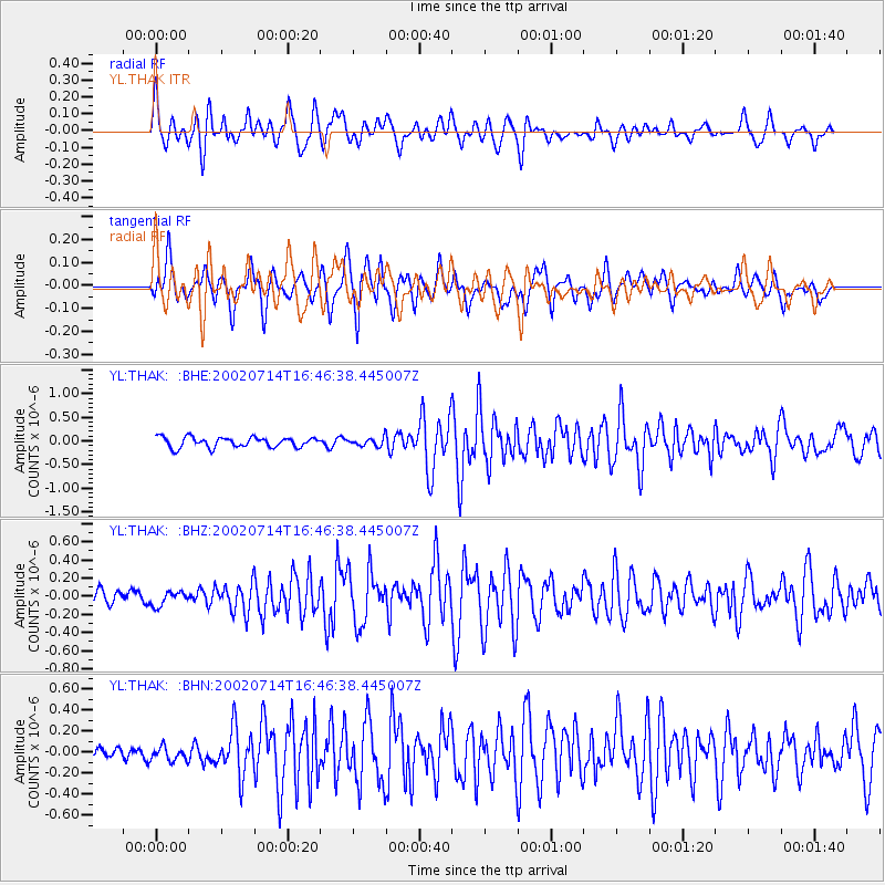
Signal To Noise
| Channel | StoN | STA | LTA |
| YL:THAK: :BHZ:20020714T16:46:38.445007Z | 0.9726422 | 7.98204E-8 | 8.206553E-8 |
| YL:THAK: :BHN:20020714T16:46:38.445007Z | 0.8707391 | 6.807847E-8 | 7.81847E-8 |
| YL:THAK: :BHE:20020714T16:46:38.445007Z | 0.81911445 | 8.6405244E-8 | 1.05486166E-7 |
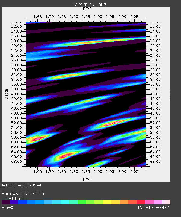
| Arrivals | |
| Ps | 8.3 SECOND |
| PpPs | 24 SECOND |
| PsPs/PpSs | 33 SECOND |

