You are here: Home > Network List > YL01 - Himalayan Nepal Tibet Experiment Stations List
> Station THAK YL.THAK > Earthquake Result Viewer
THAK YL.THAK - Earthquake Result Viewer

| Earthquake location: |
Halmahera, Indonesia |
| Earthquake latitude/longitude: |
1.8/127.2 |
| Earthquake time(UTC): |
2002/05/26 (146) 00:10:21 GMT |
| Earthquake Depth: |
109 km |
| Earthquake Magnitude: |
5.8 MB, 5.9 MW, 5.8 MW |
| Earthquake Catalog/Contributor: |
WHDF/NEIC |
|
| Network: |
YL Himalayan Nepal Tibet Experiment |
| Station: |
THAK YL.THAK |
| Lat/Lon: |
27.60 N/85.56 E |
| Elevation: |
1551 m |
|
| Distance: |
47.4 deg |
| Az: |
306.68 deg |
| Baz: |
115.416 deg |
| Ray Param: |
0.06966506 |
| Estimated Moho Depth: |
59.0 km |
| Estimated Crust Vp/Vs: |
1.62 |
| Assumed Crust Vp: |
6.142 km/s |
| Estimated Crust Vs: |
3.786 km/s |
| Estimated Crust Poisson's Ratio: |
0.19 |
|
| Radial Match: |
82.3341 % |
| Radial Bump: |
400 |
| Transverse Match: |
81.019936 % |
| Transverse Bump: |
400 |
| SOD ConfigId: |
16844 |
| Insert Time: |
2010-02-26 16:16:24.193 +0000 |
| GWidth: |
2.5 |
| Max Bumps: |
400 |
| Tol: |
0.001 |
|
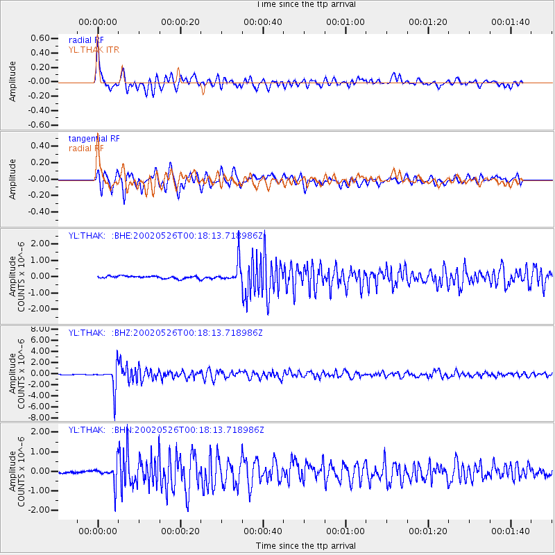
Signal To Noise
| Channel | StoN | STA | LTA |
| YL:THAK: :BHZ:20020526T00:18:13.718986Z | 37.086506 | 2.198276E-6 | 5.927428E-8 |
| YL:THAK: :BHN:20020526T00:18:13.718986Z | 5.944153 | 4.9876206E-7 | 8.390801E-8 |
| YL:THAK: :BHE:20020526T00:18:13.718986Z | 8.895486 | 6.695462E-7 | 7.526808E-8 |
| Arrivals |
| Ps | 6.4 SECOND |
| PpPs | 24 SECOND |
| PsPs/PpSs | 30 SECOND |


