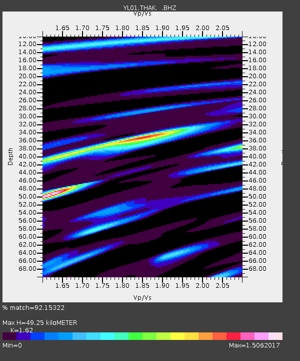
THAK YL.THAK - Earthquake Result Viewer
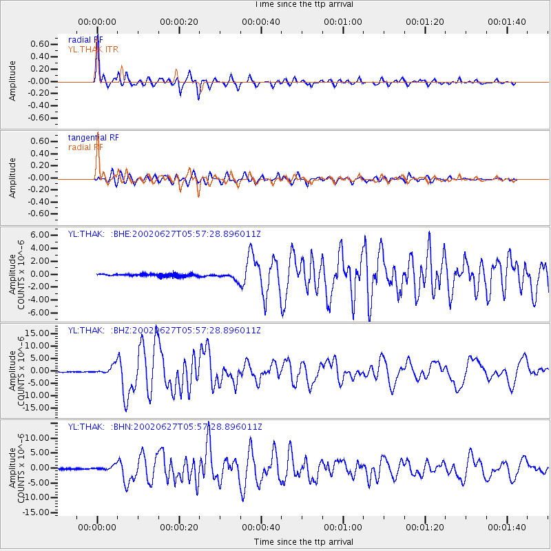
Earthquake location: Sunda Strait, Indonesia
Earthquake latitude/longitude: -7.0/104.2
Earthquake time(UTC): 2002/06/27 (178) 05:50:35 GMT
Earthquake Depth: 11 km
Earthquake Magnitude: 6.0 MB, 6.9 MS, 6.6 MW, 6.5 MW
Earthquake Catalog/Contributor: WHDF/NEIC
Network: YL Himalayan Nepal Tibet Experiment
Station: THAK YL.THAK
Lat/Lon: 27.60 N/85.56 E
Elevation: 1551 m
Distance: 38.8 deg
Az: 333.105 deg
Baz: 149.602 deg
Ray Param: 0.07535264
Estimated Moho Depth: 49.25 km
Estimated Crust Vp/Vs: 1.62
Assumed Crust Vp: 6.142 km/s
Estimated Crust Vs: 3.791 km/s
Estimated Crust Poisson's Ratio: 0.19
Radial Match: 92.15322 %
Radial Bump: 357
Transverse Match: 74.68581 %
Transverse Bump: 400
SOD ConfigId: 16844
Insert Time: 2010-02-26 16:16:28.611 +0000
GWidth: 2.5
Max Bumps: 400
Tol: 0.001

Signal To Noise

ChannelStoNSTALTA
YL:THAK: :BHZ:20020627T05:57:28.896011Z18.0716131.9301228E-61.06804116E-7
YL:THAK: :BHN:20020627T05:57:28.896011Z4.1831238.4758517E-72.026202E-7
YL:THAK: :BHE:20020627T05:57:28.896011Z3.38053586.0083465E-71.7773355E-7
Arrivals
Ps5.3 SECOND
PpPs20 SECOND
PsPs/PpSs25 SECOND