You are here: Home > Network List > GS - US Geological Survey Networks Stations List
> Station KAN13 Rinehart Farm > Earthquake Result Viewer
KAN13 Rinehart Farm - Earthquake Result Viewer
*The percent match for this event was below the threshold and hence no stack was calculated.
| Earthquake location: |
Central Mid-Atlantic Ridge |
| Earthquake latitude/longitude: |
0.8/-29.5 |
| Earthquake time(UTC): |
2018/05/24 (144) 23:11:47 GMT |
| Earthquake Depth: |
10 km |
| Earthquake Magnitude: |
5.5 Mww |
| Earthquake Catalog/Contributor: |
NEIC PDE/us |
|
| Network: |
GS US Geological Survey Networks |
| Station: |
KAN13 Rinehart Farm |
| Lat/Lon: |
37.01 N/97.48 W |
| Elevation: |
340 m |
|
| Distance: |
72.0 deg |
| Az: |
308.74 deg |
| Baz: |
103.001 deg |
| Ray Param: |
$rayparam |
*The percent match for this event was below the threshold and hence was not used in the summary stack. |
|
| Radial Match: |
30.234518 % |
| Radial Bump: |
400 |
| Transverse Match: |
29.604504 % |
| Transverse Bump: |
400 |
| SOD ConfigId: |
2665671 |
| Insert Time: |
2018-06-07 23:16:41.148 +0000 |
| GWidth: |
2.5 |
| Max Bumps: |
400 |
| Tol: |
0.001 |
|
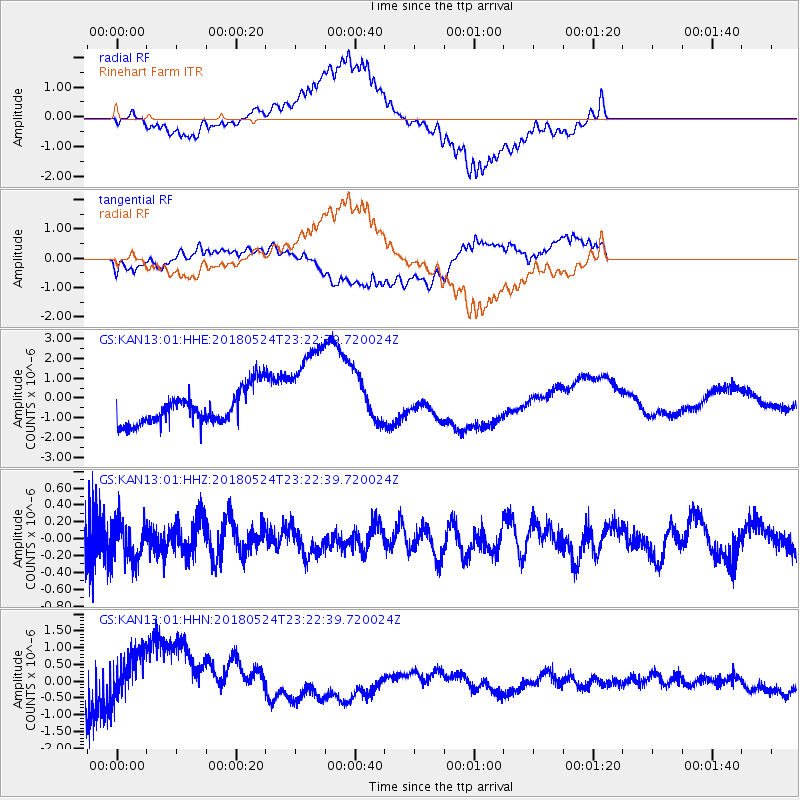
Signal To Noise
| Channel | StoN | STA | LTA |
| GS:KAN13:01:HHZ:20180524T23:22:39.720024Z | 0.7120728 | 2.2961372E-7 | 3.2245822E-7 |
| GS:KAN13:01:HHN:20180524T23:22:39.720024Z | 1.7729746 | 1.1752834E-6 | 6.628878E-7 |
| GS:KAN13:01:HHE:20180524T23:22:39.720024Z | 2.9440475 | 2.4980186E-6 | 8.484981E-7 |
| Arrivals |
| Ps | |
| PpPs | |
| PsPs/PpSs | |


