You are here: Home > Network List > US - United States National Seismic Network Stations List
> Station HAWA Hanford, Washington, USA > Earthquake Result Viewer
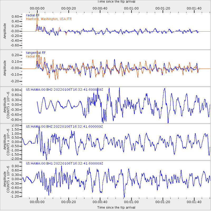
HAWA Hanford, Washington, USA - Earthquake Result Viewer
*The percent match for this event was below the threshold and hence no stack was calculated.
| Earthquake location: |
Near Coast Of Nicaragua |
| Earthquake latitude/longitude: |
12.0/-87.1 |
| Earthquake time(UTC): |
2022/01/06 (006) 16:25:07 GMT |
| Earthquake Depth: |
22 km |
| Earthquake Magnitude: |
6.1 mww |
| Earthquake Catalog/Contributor: |
NEIC PDE/us |
|
| Network: |
US United States National Seismic Network |
| Station: |
HAWA Hanford, Washington, USA |
| Lat/Lon: |
46.39 N/119.53 W |
| Elevation: |
364 m |
|
| Distance: |
43.9 deg |
| Az: |
327.652 deg |
| Baz: |
130.848 deg |
| Ray Param: |
$rayparam |
*The percent match for this event was below the threshold and hence was not used in the summary stack. |
|
| Radial Match: |
62.813858 % |
| Radial Bump: |
400 |
| Transverse Match: |
38.804665 % |
| Transverse Bump: |
400 |
| SOD ConfigId: |
26694651 |
| Insert Time: |
2022-01-20 16:49:11.364 +0000 |
| GWidth: |
2.5 |
| Max Bumps: |
400 |
| Tol: |
0.001 |
|
Signal To Noise
| Channel | StoN | STA | LTA |
| US:HAWA:00:BHZ:20220106T16:32:41.600009Z | 2.3529978 | 9.5808E-7 | 4.071742E-7 |
| US:HAWA:00:BH1:20220106T16:32:41.600009Z | 1.781195 | 3.357618E-7 | 1.8850366E-7 |
| US:HAWA:00:BH2:20220106T16:32:41.600009Z | 1.9346737 | 4.1791688E-7 | 2.1601416E-7 |
| Arrivals |
| Ps | |
| PpPs | |
| PsPs/PpSs | |


