You are here: Home > Network List > UW - Pacific Northwest Regional Seismic Network Stations List
> Station HOOD Mt Hood Meadows, OR CREST BB SMO > Earthquake Result Viewer
HOOD Mt Hood Meadows, OR CREST BB SMO - Earthquake Result Viewer
*The percent match for this event was below the threshold and hence no stack was calculated.
| Earthquake location: |
Near Coast Of Nicaragua |
| Earthquake latitude/longitude: |
12.0/-87.1 |
| Earthquake time(UTC): |
2022/01/06 (006) 16:25:07 GMT |
| Earthquake Depth: |
22 km |
| Earthquake Magnitude: |
6.1 mww |
| Earthquake Catalog/Contributor: |
NEIC PDE/us |
|
| Network: |
UW Pacific Northwest Regional Seismic Network |
| Station: |
HOOD Mt Hood Meadows, OR CREST BB SMO |
| Lat/Lon: |
45.32 N/121.65 W |
| Elevation: |
1520 m |
|
| Distance: |
44.4 deg |
| Az: |
325.115 deg |
| Baz: |
127.51 deg |
| Ray Param: |
$rayparam |
*The percent match for this event was below the threshold and hence was not used in the summary stack. |
|
| Radial Match: |
77.50474 % |
| Radial Bump: |
400 |
| Transverse Match: |
59.66248 % |
| Transverse Bump: |
400 |
| SOD ConfigId: |
26694651 |
| Insert Time: |
2022-01-20 16:50:33.320 +0000 |
| GWidth: |
2.5 |
| Max Bumps: |
400 |
| Tol: |
0.001 |
|
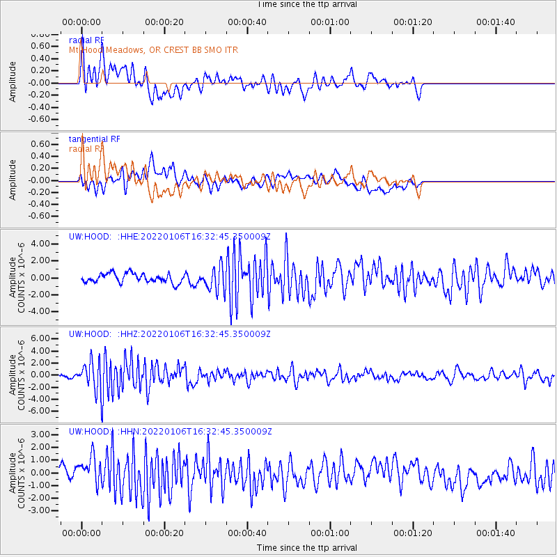
Signal To Noise
| Channel | StoN | STA | LTA |
| UW:HOOD: :HHZ:20220106T16:32:45.350009Z | 7.2205915 | 2.3777186E-6 | 3.292969E-7 |
| UW:HOOD: :HHN:20220106T16:32:45.350009Z | 2.9624407 | 1.1433123E-6 | 3.859359E-7 |
| UW:HOOD: :HHE:20220106T16:32:45.350009Z | 2.653394 | 1.4311476E-6 | 5.393649E-7 |
| Arrivals |
| Ps | |
| PpPs | |
| PsPs/PpSs | |


