You are here: Home > Network List > C8 - Canadian Seismic Research Network () Stations List
> Station GRIB Gribbell Island, BC, CA > Earthquake Result Viewer
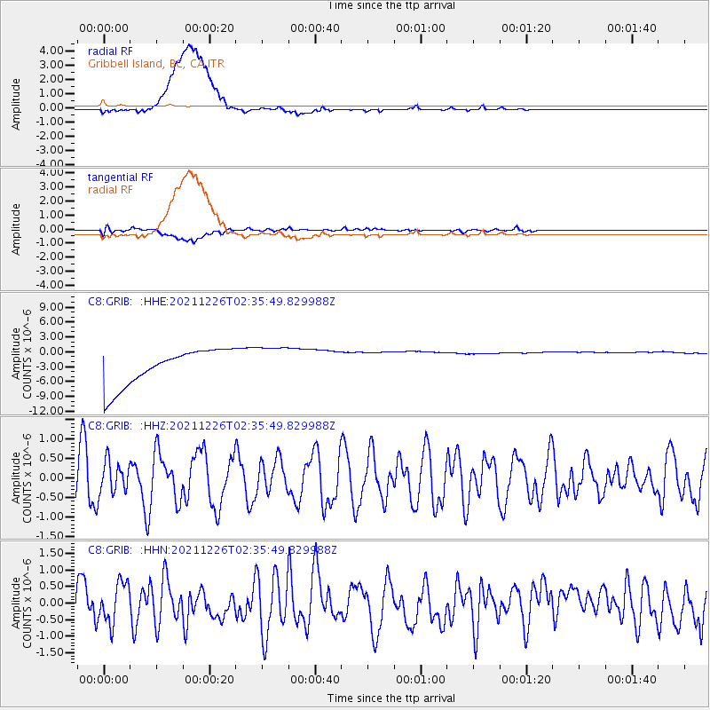
GRIB Gribbell Island, BC, CA - Earthquake Result Viewer
*The percent match for this event was below the threshold and hence no stack was calculated.
| Earthquake location: |
Northern Molucca Sea |
| Earthquake latitude/longitude: |
2.1/126.6 |
| Earthquake time(UTC): |
2021/12/26 (360) 02:22:53 GMT |
| Earthquake Depth: |
26 km |
| Earthquake Magnitude: |
5.3 Mww |
| Earthquake Catalog/Contributor: |
NEIC PDE/us |
|
| Network: |
C8 Canadian Seismic Research Network () |
| Station: |
GRIB Gribbell Island, BC, CA |
| Lat/Lon: |
53.34 N/129.14 W |
| Elevation: |
418 m |
|
| Distance: |
96.8 deg |
| Az: |
35.826 deg |
| Baz: |
282.731 deg |
| Ray Param: |
$rayparam |
*The percent match for this event was below the threshold and hence was not used in the summary stack. |
|
| Radial Match: |
46.80385 % |
| Radial Bump: |
400 |
| Transverse Match: |
52.531918 % |
| Transverse Bump: |
400 |
| SOD ConfigId: |
26694651 |
| Insert Time: |
2022-01-20 23:22:14.670 +0000 |
| GWidth: |
2.5 |
| Max Bumps: |
400 |
| Tol: |
0.001 |
|
Signal To Noise
| Channel | StoN | STA | LTA |
| C8:GRIB: :HHZ:20211226T02:35:49.829988Z | 0.46643126 | 3.997084E-7 | 8.569503E-7 |
| C8:GRIB: :HHN:20211226T02:35:49.829988Z | 0.9462366 | 6.0793093E-7 | 6.424724E-7 |
| C8:GRIB: :HHE:20211226T02:35:49.829988Z | 1.0280854 | 3.7810162E-6 | 3.6777258E-6 |
| Arrivals |
| Ps | |
| PpPs | |
| PsPs/PpSs | |


