You are here: Home > Network List > IU - Global Seismograph Network (GSN - IRIS/USGS) Stations List
> Station RSSD Black Hills, South Dakota, USA > Earthquake Result Viewer
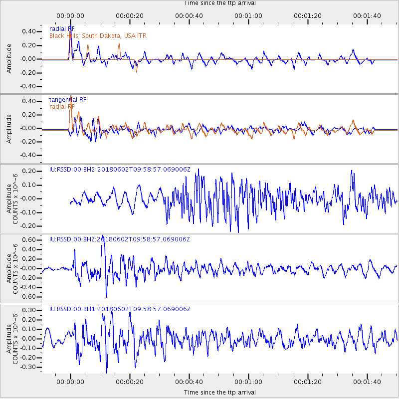
RSSD Black Hills, South Dakota, USA - Earthquake Result Viewer
*The percent match for this event was below the threshold and hence no stack was calculated.
| Earthquake location: |
East Of Kuril Islands |
| Earthquake latitude/longitude: |
43.9/148.0 |
| Earthquake time(UTC): |
2018/06/02 (153) 09:48:08 GMT |
| Earthquake Depth: |
10 km |
| Earthquake Magnitude: |
5.5 Mww |
| Earthquake Catalog/Contributor: |
NEIC PDE/us |
|
| Network: |
IU Global Seismograph Network (GSN - IRIS/USGS) |
| Station: |
RSSD Black Hills, South Dakota, USA |
| Lat/Lon: |
44.12 N/104.04 W |
| Elevation: |
2090 m |
|
| Distance: |
71.4 deg |
| Az: |
46.321 deg |
| Baz: |
313.503 deg |
| Ray Param: |
$rayparam |
*The percent match for this event was below the threshold and hence was not used in the summary stack. |
|
| Radial Match: |
72.4078 % |
| Radial Bump: |
400 |
| Transverse Match: |
69.11154 % |
| Transverse Bump: |
400 |
| SOD ConfigId: |
2709371 |
| Insert Time: |
2018-06-16 09:52:11.137 +0000 |
| GWidth: |
2.5 |
| Max Bumps: |
400 |
| Tol: |
0.001 |
|
Signal To Noise
| Channel | StoN | STA | LTA |
| IU:RSSD:00:BHZ:20180602T09:58:57.069006Z | 2.7204938 | 1.5952385E-7 | 5.8637827E-8 |
| IU:RSSD:00:BH1:20180602T09:58:57.069006Z | 2.4441977 | 1.2242455E-7 | 5.0087827E-8 |
| IU:RSSD:00:BH2:20180602T09:58:57.069006Z | 1.558169 | 6.806162E-8 | 4.3680508E-8 |
| Arrivals |
| Ps | |
| PpPs | |
| PsPs/PpSs | |


