You are here: Home > Network List > IW - Intermountain West Stations List
> Station PLID Pearl Lake, Idaho, USA > Earthquake Result Viewer
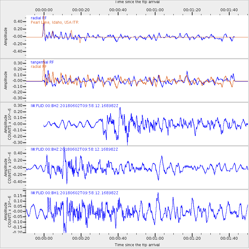
PLID Pearl Lake, Idaho, USA - Earthquake Result Viewer
*The percent match for this event was below the threshold and hence no stack was calculated.
| Earthquake location: |
East Of Kuril Islands |
| Earthquake latitude/longitude: |
43.9/148.0 |
| Earthquake time(UTC): |
2018/06/02 (153) 09:48:08 GMT |
| Earthquake Depth: |
10 km |
| Earthquake Magnitude: |
5.5 Mww |
| Earthquake Catalog/Contributor: |
NEIC PDE/us |
|
| Network: |
IW Intermountain West |
| Station: |
PLID Pearl Lake, Idaho, USA |
| Lat/Lon: |
45.09 N/116.00 W |
| Elevation: |
2164 m |
|
| Distance: |
64.2 deg |
| Az: |
51.49 deg |
| Baz: |
307.073 deg |
| Ray Param: |
$rayparam |
*The percent match for this event was below the threshold and hence was not used in the summary stack. |
|
| Radial Match: |
40.223736 % |
| Radial Bump: |
400 |
| Transverse Match: |
56.663734 % |
| Transverse Bump: |
400 |
| SOD ConfigId: |
2709371 |
| Insert Time: |
2018-06-16 09:52:35.917 +0000 |
| GWidth: |
2.5 |
| Max Bumps: |
400 |
| Tol: |
0.001 |
|
Signal To Noise
| Channel | StoN | STA | LTA |
| IW:PLID:00:BHZ:20180602T09:58:12.168982Z | 2.944147 | 1.443279E-7 | 4.9021978E-8 |
| IW:PLID:00:BH1:20180602T09:58:12.168982Z | 1.1112068 | 5.8787542E-8 | 5.2904234E-8 |
| IW:PLID:00:BH2:20180602T09:58:12.168982Z | 2.9992461 | 1.0377376E-7 | 3.4599946E-8 |
| Arrivals |
| Ps | |
| PpPs | |
| PsPs/PpSs | |


