You are here: Home > Network List > US - United States National Seismic Network Stations List
> Station AMTX Amarillo, Texas, USA > Earthquake Result Viewer
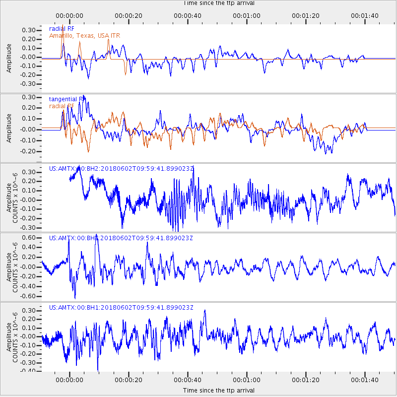
AMTX Amarillo, Texas, USA - Earthquake Result Viewer
*The percent match for this event was below the threshold and hence no stack was calculated.
| Earthquake location: |
East Of Kuril Islands |
| Earthquake latitude/longitude: |
43.9/148.0 |
| Earthquake time(UTC): |
2018/06/02 (153) 09:48:08 GMT |
| Earthquake Depth: |
10 km |
| Earthquake Magnitude: |
5.5 Mww |
| Earthquake Catalog/Contributor: |
NEIC PDE/us |
|
| Network: |
US United States National Seismic Network |
| Station: |
AMTX Amarillo, Texas, USA |
| Lat/Lon: |
34.53 N/101.41 W |
| Elevation: |
1010 m |
|
| Distance: |
79.6 deg |
| Az: |
51.818 deg |
| Baz: |
316.551 deg |
| Ray Param: |
$rayparam |
*The percent match for this event was below the threshold and hence was not used in the summary stack. |
|
| Radial Match: |
43.11987 % |
| Radial Bump: |
400 |
| Transverse Match: |
27.938627 % |
| Transverse Bump: |
400 |
| SOD ConfigId: |
2709371 |
| Insert Time: |
2018-06-16 09:55:48.673 +0000 |
| GWidth: |
2.5 |
| Max Bumps: |
400 |
| Tol: |
0.001 |
|
Signal To Noise
| Channel | StoN | STA | LTA |
| US:AMTX:00:BHZ:20180602T09:59:41.899023Z | 2.5398498 | 2.8347927E-7 | 1.11612614E-7 |
| US:AMTX:00:BH1:20180602T09:59:41.899023Z | 1.7273276 | 1.9875354E-7 | 1.1506419E-7 |
| US:AMTX:00:BH2:20180602T09:59:41.899023Z | 1.438322 | 1.9580823E-7 | 1.3613658E-7 |
| Arrivals |
| Ps | |
| PpPs | |
| PsPs/PpSs | |


