You are here: Home > Network List > US - United States National Seismic Network Stations List
> Station EGMT Eagleton, Montana, USA > Earthquake Result Viewer
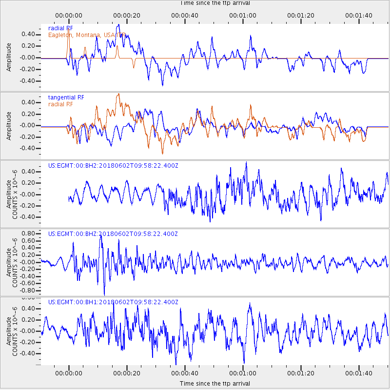
EGMT Eagleton, Montana, USA - Earthquake Result Viewer
*The percent match for this event was below the threshold and hence no stack was calculated.
| Earthquake location: |
East Of Kuril Islands |
| Earthquake latitude/longitude: |
43.9/148.0 |
| Earthquake time(UTC): |
2018/06/02 (153) 09:48:08 GMT |
| Earthquake Depth: |
10 km |
| Earthquake Magnitude: |
5.5 Mww |
| Earthquake Catalog/Contributor: |
NEIC PDE/us |
|
| Network: |
US United States National Seismic Network |
| Station: |
EGMT Eagleton, Montana, USA |
| Lat/Lon: |
48.02 N/109.75 W |
| Elevation: |
1055 m |
|
| Distance: |
65.8 deg |
| Az: |
46.006 deg |
| Baz: |
309.278 deg |
| Ray Param: |
$rayparam |
*The percent match for this event was below the threshold and hence was not used in the summary stack. |
|
| Radial Match: |
56.64779 % |
| Radial Bump: |
400 |
| Transverse Match: |
47.55179 % |
| Transverse Bump: |
400 |
| SOD ConfigId: |
2709371 |
| Insert Time: |
2018-06-16 09:56:10.317 +0000 |
| GWidth: |
2.5 |
| Max Bumps: |
400 |
| Tol: |
0.001 |
|
Signal To Noise
| Channel | StoN | STA | LTA |
| US:EGMT:00:BHZ:20180602T09:58:22.400Z | 3.9223218 | 2.508419E-7 | 6.3952406E-8 |
| US:EGMT:00:BH1:20180602T09:58:22.400Z | 1.113953 | 1.7112019E-7 | 1.5361526E-7 |
| US:EGMT:00:BH2:20180602T09:58:22.400Z | 1.4363029 | 1.5271887E-7 | 1.0632776E-7 |
| Arrivals |
| Ps | |
| PpPs | |
| PsPs/PpSs | |


