You are here: Home > Network List > US - United States National Seismic Network Stations List
> Station HAWA Hanford, Washington, USA > Earthquake Result Viewer
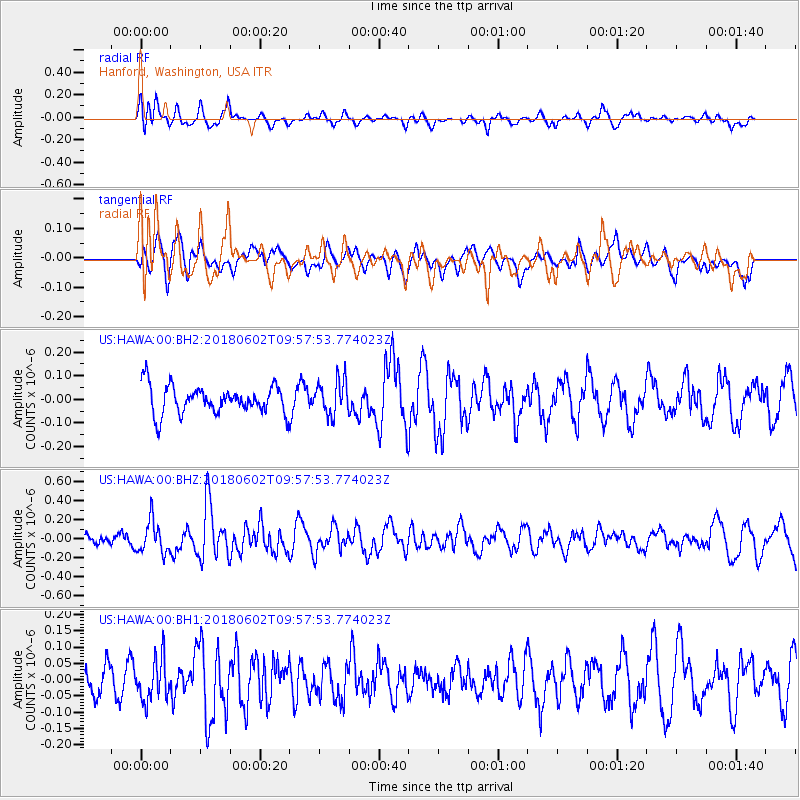
HAWA Hanford, Washington, USA - Earthquake Result Viewer
*The percent match for this event was below the threshold and hence no stack was calculated.
| Earthquake location: |
East Of Kuril Islands |
| Earthquake latitude/longitude: |
43.9/148.0 |
| Earthquake time(UTC): |
2018/06/02 (153) 09:48:08 GMT |
| Earthquake Depth: |
10 km |
| Earthquake Magnitude: |
5.5 Mww |
| Earthquake Catalog/Contributor: |
NEIC PDE/us |
|
| Network: |
US United States National Seismic Network |
| Station: |
HAWA Hanford, Washington, USA |
| Lat/Lon: |
46.39 N/119.53 W |
| Elevation: |
364 m |
|
| Distance: |
61.4 deg |
| Az: |
51.933 deg |
| Baz: |
304.753 deg |
| Ray Param: |
$rayparam |
*The percent match for this event was below the threshold and hence was not used in the summary stack. |
|
| Radial Match: |
45.127663 % |
| Radial Bump: |
400 |
| Transverse Match: |
46.827732 % |
| Transverse Bump: |
400 |
| SOD ConfigId: |
2709371 |
| Insert Time: |
2018-06-16 09:56:18.070 +0000 |
| GWidth: |
2.5 |
| Max Bumps: |
400 |
| Tol: |
0.001 |
|
Signal To Noise
| Channel | StoN | STA | LTA |
| US:HAWA:00:BHZ:20180602T09:57:53.774023Z | 2.5697677 | 1.675871E-7 | 6.5214884E-8 |
| US:HAWA:00:BH1:20180602T09:57:53.774023Z | 0.9760608 | 6.4444265E-8 | 6.6024846E-8 |
| US:HAWA:00:BH2:20180602T09:57:53.774023Z | 1.2251518 | 7.157679E-8 | 5.8422792E-8 |
| Arrivals |
| Ps | |
| PpPs | |
| PsPs/PpSs | |


