TUML YL.TUML - Earthquake Result Viewer
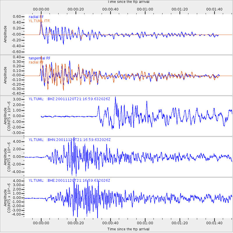
Earthquake location: Banda Sea
Earthquake latitude/longitude: -6.9/128.9
Earthquake time(UTC): 2001/11/20 (324) 21:08:18 GMT
Earthquake Depth: 33 km
Earthquake Magnitude: 5.7 MB, 6.0 MS, 6.3 MW, 6.2 MW
Earthquake Catalog/Contributor: WHDF/NEIC
Network: YL Himalayan Nepal Tibet Experiment
Station: TUML YL.TUML
Lat/Lon: 27.32 N/87.19 E
Elevation: 360 m
Distance: 52.8 deg
Az: 311.954 deg
Baz: 123.907 deg
Ray Param: 0.06648247
Estimated Moho Depth: 23.5 km
Estimated Crust Vp/Vs: 1.77
Assumed Crust Vp: 6.236 km/s
Estimated Crust Vs: 3.523 km/s
Estimated Crust Poisson's Ratio: 0.27
Radial Match: 80.89924 %
Radial Bump: 400
Transverse Match: 69.42329 %
Transverse Bump: 400
SOD ConfigId: 16820
Insert Time: 2010-02-26 16:17:20.796 +0000
GWidth: 2.5
Max Bumps: 400
Tol: 0.001

Signal To Noise

ChannelStoNSTALTA
YL:TUML: :BHN:20011120T21:16:59.632026Z4.382932.3048587E-75.258717E-8
YL:TUML: :BHE:20011120T21:16:59.632026Z4.94090182.0079766E-74.063988E-8
YL:TUML: :BHZ:20011120T21:16:59.632026Z14.2073136.5576523E-74.6156877E-8
Arrivals
Ps3.1 SECOND
PpPs9.9 SECOND
PsPs/PpSs13 SECOND