TUML YL.TUML - Earthquake Result Viewer
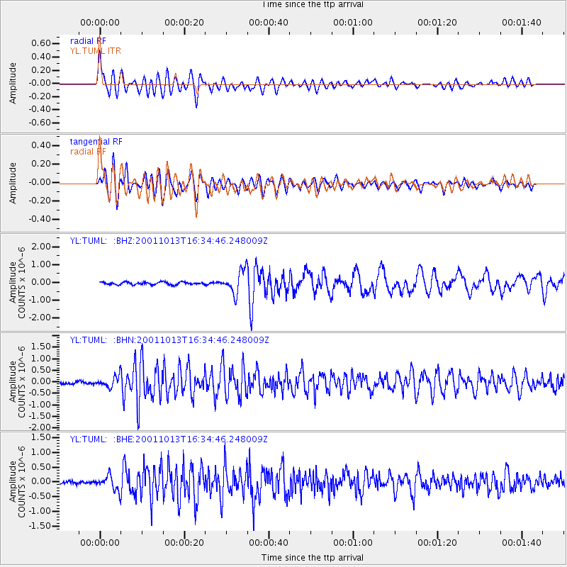
Earthquake location: Northern Molucca Sea
Earthquake latitude/longitude: 0.8/126.0
Earthquake time(UTC): 2001/10/13 (286) 16:27:00 GMT
Earthquake Depth: 33 km
Earthquake Magnitude: 5.6 MB, 5.7 MS, 6.0 MW, 5.8 MW
Earthquake Catalog/Contributor: WHDF/NEIC
Network: YL Himalayan Nepal Tibet Experiment
Station: TUML YL.TUML
Lat/Lon: 27.32 N/87.19 E
Elevation: 360 m
Distance: 45.6 deg
Az: 308.695 deg
Baz: 118.699 deg
Ray Param: 0.071126215
Estimated Moho Depth: 44.5 km
Estimated Crust Vp/Vs: 1.67
Assumed Crust Vp: 6.236 km/s
Estimated Crust Vs: 3.734 km/s
Estimated Crust Poisson's Ratio: 0.22
Radial Match: 84.158104 %
Radial Bump: 400
Transverse Match: 81.06551 %
Transverse Bump: 400
SOD ConfigId: 16820
Insert Time: 2010-02-26 16:17:24.290 +0000
GWidth: 2.5
Max Bumps: 400
Tol: 0.001

Signal To Noise

ChannelStoNSTALTA
YL:TUML: :BHN:20011013T16:34:46.248009Z3.55074452.4182836E-76.810638E-8
YL:TUML: :BHE:20011013T16:34:46.248009Z5.35226352.540985E-74.747496E-8
YL:TUML: :BHZ:20011013T16:34:46.248009Z9.6842296.752879E-76.973068E-8
Arrivals
Ps5.1 SECOND
PpPs18 SECOND
PsPs/PpSs23 SECOND