TUML YL.TUML - Earthquake Result Viewer
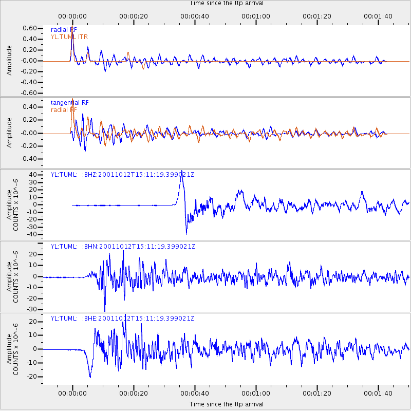
Earthquake location: South Of Mariana Islands
Earthquake latitude/longitude: 12.7/145.0
Earthquake time(UTC): 2001/10/12 (285) 15:02:16 GMT
Earthquake Depth: 37 km
Earthquake Magnitude: 6.7 MB, 7.3 MS, 7.0 MW, 6.9 MW
Earthquake Catalog/Contributor: WHDF/NEIC
Network: YL Himalayan Nepal Tibet Experiment
Station: TUML YL.TUML
Lat/Lon: 27.32 N/87.19 E
Elevation: 360 m
Distance: 55.8 deg
Az: 294.437 deg
Baz: 93.007 deg
Ray Param: 0.06450389
Estimated Moho Depth: 21.5 km
Estimated Crust Vp/Vs: 1.83
Assumed Crust Vp: 6.236 km/s
Estimated Crust Vs: 3.412 km/s
Estimated Crust Poisson's Ratio: 0.29
Radial Match: 86.08296 %
Radial Bump: 400
Transverse Match: 79.80992 %
Transverse Bump: 400
SOD ConfigId: 16820
Insert Time: 2010-02-26 16:17:25.431 +0000
GWidth: 2.5
Max Bumps: 400
Tol: 0.001

Signal To Noise

ChannelStoNSTALTA
YL:TUML: :BHN:20011012T15:11:19.399021Z5.3290363.0986072E-75.8145734E-8
YL:TUML: :BHE:20011012T15:11:19.399021Z33.107421.8874312E-65.7009306E-8
YL:TUML: :BHZ:20011012T15:11:19.399021Z45.704524.6343207E-61.01397426E-7
Arrivals
Ps3.0 SECOND
PpPs9.3 SECOND
PsPs/PpSs12 SECOND