You are here: Home > Network List > US - United States National Seismic Network Stations List
> Station EGMT Eagleton, Montana, USA > Earthquake Result Viewer
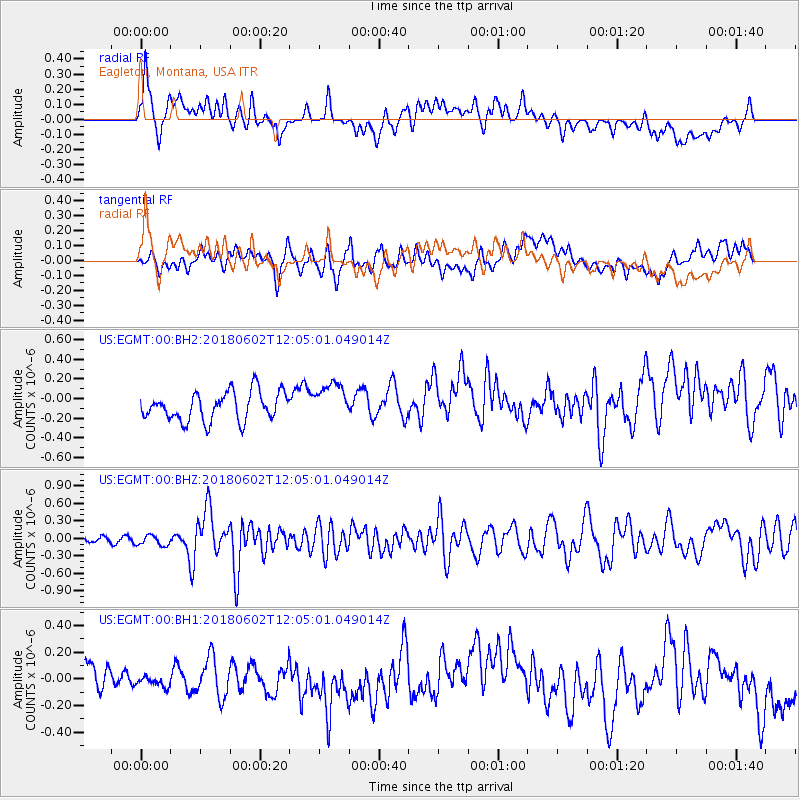
EGMT Eagleton, Montana, USA - Earthquake Result Viewer
*The percent match for this event was below the threshold and hence no stack was calculated.
| Earthquake location: |
Samoa Islands Region |
| Earthquake latitude/longitude: |
-14.8/-173.1 |
| Earthquake time(UTC): |
2018/06/02 (153) 11:53:06 GMT |
| Earthquake Depth: |
50 km |
| Earthquake Magnitude: |
5.6 mb |
| Earthquake Catalog/Contributor: |
NEIC PDE/us |
|
| Network: |
US United States National Seismic Network |
| Station: |
EGMT Eagleton, Montana, USA |
| Lat/Lon: |
48.02 N/109.75 W |
| Elevation: |
1055 m |
|
| Distance: |
84.1 deg |
| Az: |
37.101 deg |
| Baz: |
240.37 deg |
| Ray Param: |
$rayparam |
*The percent match for this event was below the threshold and hence was not used in the summary stack. |
|
| Radial Match: |
50.124935 % |
| Radial Bump: |
400 |
| Transverse Match: |
48.430565 % |
| Transverse Bump: |
400 |
| SOD ConfigId: |
2709371 |
| Insert Time: |
2018-06-16 11:57:44.871 +0000 |
| GWidth: |
2.5 |
| Max Bumps: |
400 |
| Tol: |
0.001 |
|
Signal To Noise
| Channel | StoN | STA | LTA |
| US:EGMT:00:BHZ:20180602T12:05:01.049014Z | 1.5306352 | 8.808214E-8 | 5.754613E-8 |
| US:EGMT:00:BH1:20180602T12:05:01.049014Z | 0.24638323 | 4.129042E-8 | 1.6758615E-7 |
| US:EGMT:00:BH2:20180602T12:05:01.049014Z | 1.3046869 | 1.8892231E-7 | 1.448028E-7 |
| Arrivals |
| Ps | |
| PpPs | |
| PsPs/PpSs | |


