
TUML YL.TUML - Earthquake Result Viewer
| ||||||||||||||||||
| ||||||||||||||||||
| ||||||||||||||||||
|
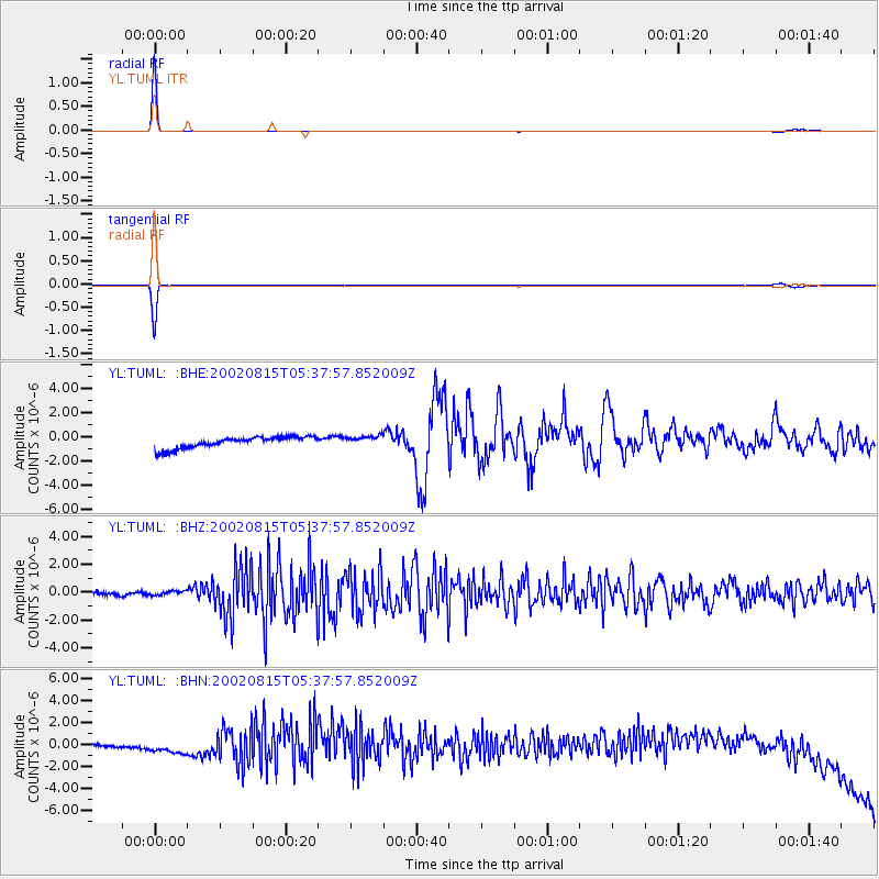
Signal To Noise
| Channel | StoN | STA | LTA |
| YL:TUML: :BHZ:20020815T05:37:57.852009Z | 0.78326404 | 1.6859912E-7 | 2.1525196E-7 |
| YL:TUML: :BHN:20020815T05:37:57.852009Z | 3.1822963 | 7.988029E-7 | 2.510146E-7 |
| YL:TUML: :BHE:20020815T05:37:57.852009Z | 0.8860603 | 4.182567E-7 | 4.720409E-7 |
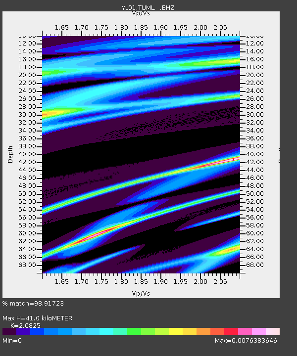
| Arrivals | |
| Ps | 7.5 SECOND |
| PpPs | 19 SECOND |
| PsPs/PpSs | 27 SECOND |

