You are here: Home > Network List > IU - Global Seismograph Network (GSN - IRIS/USGS) Stations List
> Station RSSD Black Hills, South Dakota, USA > Earthquake Result Viewer
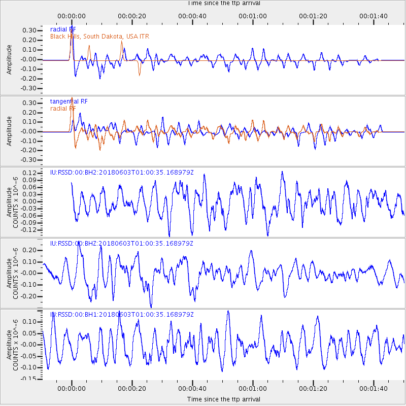
RSSD Black Hills, South Dakota, USA - Earthquake Result Viewer
*The percent match for this event was below the threshold and hence no stack was calculated.
| Earthquake location: |
Tonga Islands |
| Earthquake latitude/longitude: |
-19.4/-173.7 |
| Earthquake time(UTC): |
2018/06/03 (154) 00:48:09 GMT |
| Earthquake Depth: |
10 km |
| Earthquake Magnitude: |
5.6 mb |
| Earthquake Catalog/Contributor: |
NEIC PDE/us |
|
| Network: |
IU Global Seismograph Network (GSN - IRIS/USGS) |
| Station: |
RSSD Black Hills, South Dakota, USA |
| Lat/Lon: |
44.12 N/104.04 W |
| Elevation: |
2090 m |
|
| Distance: |
89.6 deg |
| Az: |
42.474 deg |
| Baz: |
242.249 deg |
| Ray Param: |
$rayparam |
*The percent match for this event was below the threshold and hence was not used in the summary stack. |
|
| Radial Match: |
69.38492 % |
| Radial Bump: |
400 |
| Transverse Match: |
61.626453 % |
| Transverse Bump: |
400 |
| SOD ConfigId: |
2709371 |
| Insert Time: |
2018-06-17 00:52:50.880 +0000 |
| GWidth: |
2.5 |
| Max Bumps: |
400 |
| Tol: |
0.001 |
|
Signal To Noise
| Channel | StoN | STA | LTA |
| IU:RSSD:00:BHZ:20180603T01:00:35.168979Z | 2.8938453 | 1.3634279E-7 | 4.711475E-8 |
| IU:RSSD:00:BH1:20180603T01:00:35.168979Z | 0.81685436 | 3.9727272E-8 | 4.863446E-8 |
| IU:RSSD:00:BH2:20180603T01:00:35.168979Z | 1.7022799 | 6.4680975E-8 | 3.7996674E-8 |
| Arrivals |
| Ps | |
| PpPs | |
| PsPs/PpSs | |


