You are here: Home > Network List > YL01 - Himalayan Nepal Tibet Experiment Stations List
> Station TUML YL.TUML > Earthquake Result Viewer
TUML YL.TUML - Earthquake Result Viewer

| Earthquake location: |
Banda Sea |
| Earthquake latitude/longitude: |
-6.5/129.9 |
| Earthquake time(UTC): |
2002/03/19 (078) 22:14:14 GMT |
| Earthquake Depth: |
148 km |
| Earthquake Magnitude: |
5.7 MB, 6.1 MW, 6.0 MW |
| Earthquake Catalog/Contributor: |
WHDF/NEIC |
|
| Network: |
YL Himalayan Nepal Tibet Experiment |
| Station: |
TUML YL.TUML |
| Lat/Lon: |
27.32 N/87.19 E |
| Elevation: |
360 m |
|
| Distance: |
53.2 deg |
| Az: |
311.133 deg |
| Baz: |
122.732 deg |
| Ray Param: |
0.06572232 |
| Estimated Moho Depth: |
45.0 km |
| Estimated Crust Vp/Vs: |
1.64 |
| Assumed Crust Vp: |
6.236 km/s |
| Estimated Crust Vs: |
3.791 km/s |
| Estimated Crust Poisson's Ratio: |
0.21 |
|
| Radial Match: |
82.55585 % |
| Radial Bump: |
400 |
| Transverse Match: |
80.70121 % |
| Transverse Bump: |
400 |
| SOD ConfigId: |
16820 |
| Insert Time: |
2010-02-26 16:17:40.410 +0000 |
| GWidth: |
2.5 |
| Max Bumps: |
400 |
| Tol: |
0.001 |
|
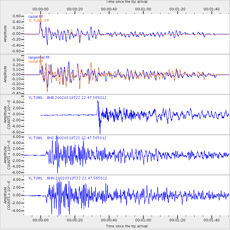
Signal To Noise
| Channel | StoN | STA | LTA |
| YL:TUML: :BHZ:20020319T22:22:47.56501Z | 6.1399245 | 4.3385856E-7 | 7.0661876E-8 |
| YL:TUML: :BHN:20020319T22:22:47.56501Z | 10.448578 | 5.6911557E-7 | 5.446823E-8 |
| YL:TUML: :BHE:20020319T22:22:47.56501Z | 28.868341 | 1.9178644E-6 | 6.6434865E-8 |
| Arrivals |
| Ps | 4.9 SECOND |
| PpPs | 18 SECOND |
| PsPs/PpSs | 23 SECOND |


