You are here: Home > Network List > IW - Intermountain West Stations List
> Station MOOW Moose Ponds, Wyoming, USA > Earthquake Result Viewer
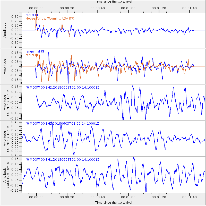
MOOW Moose Ponds, Wyoming, USA - Earthquake Result Viewer
*The percent match for this event was below the threshold and hence no stack was calculated.
| Earthquake location: |
Tonga Islands |
| Earthquake latitude/longitude: |
-19.4/-173.7 |
| Earthquake time(UTC): |
2018/06/03 (154) 00:48:09 GMT |
| Earthquake Depth: |
10 km |
| Earthquake Magnitude: |
5.6 mb |
| Earthquake Catalog/Contributor: |
NEIC PDE/us |
|
| Network: |
IW Intermountain West |
| Station: |
MOOW Moose Ponds, Wyoming, USA |
| Lat/Lon: |
43.75 N/110.74 W |
| Elevation: |
2128 m |
|
| Distance: |
85.2 deg |
| Az: |
40.362 deg |
| Baz: |
237.512 deg |
| Ray Param: |
$rayparam |
*The percent match for this event was below the threshold and hence was not used in the summary stack. |
|
| Radial Match: |
73.09236 % |
| Radial Bump: |
400 |
| Transverse Match: |
68.53094 % |
| Transverse Bump: |
400 |
| SOD ConfigId: |
2709371 |
| Insert Time: |
2018-06-17 00:53:07.882 +0000 |
| GWidth: |
2.5 |
| Max Bumps: |
400 |
| Tol: |
0.001 |
|
Signal To Noise
| Channel | StoN | STA | LTA |
| IW:MOOW:00:BHZ:20180603T01:00:14.10001Z | 1.6631364 | 1.124013E-7 | 6.758394E-8 |
| IW:MOOW:00:BH1:20180603T01:00:14.10001Z | 1.176196 | 4.1807652E-8 | 3.55448E-8 |
| IW:MOOW:00:BH2:20180603T01:00:14.10001Z | 1.3440331 | 4.5290047E-8 | 3.3697123E-8 |
| Arrivals |
| Ps | |
| PpPs | |
| PsPs/PpSs | |


