TUML YL.TUML - Earthquake Result Viewer
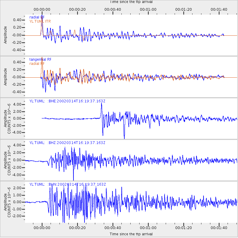
Earthquake location: Andreanof Islands, Aleutian Is.
Earthquake latitude/longitude: 51.5/-173.1
Earthquake time(UTC): 2002/03/14 (073) 16:08:31 GMT
Earthquake Depth: 33 km
Earthquake Magnitude: 5.5 MB, 5.4 MS, 5.9 MW, 5.6 MW
Earthquake Catalog/Contributor: WHDF/NEIC
Network: YL Himalayan Nepal Tibet Experiment
Station: TUML YL.TUML
Lat/Lon: 27.32 N/87.19 E
Elevation: 360 m
Distance: 74.8 deg
Az: 294.655 deg
Baz: 39.649 deg
Ray Param: 0.052061405
Estimated Moho Depth: 23.25 km
Estimated Crust Vp/Vs: 1.82
Assumed Crust Vp: 6.236 km/s
Estimated Crust Vs: 3.426 km/s
Estimated Crust Poisson's Ratio: 0.28
Radial Match: 89.8591 %
Radial Bump: 400
Transverse Match: 87.47214 %
Transverse Bump: 400
SOD ConfigId: 16820
Insert Time: 2010-02-26 16:17:42.546 +0000
GWidth: 2.5
Max Bumps: 400
Tol: 0.001

Signal To Noise

ChannelStoNSTALTA
YL:TUML: :BHZ:20020314T16:19:37.163Z5.301144.3060402E-78.122857E-8
YL:TUML: :BHN:20020314T16:19:37.163Z9.7958396.31188E-76.4434296E-8
YL:TUML: :BHE:20020314T16:19:37.163Z18.6032491.6603434E-68.9250186E-8
Arrivals
Ps3.2 SECOND
PpPs10 SECOND
PsPs/PpSs13 SECOND