You are here: Home > Network List > US - United States National Seismic Network Stations List
> Station ELK Elko, Nevada, USA > Earthquake Result Viewer
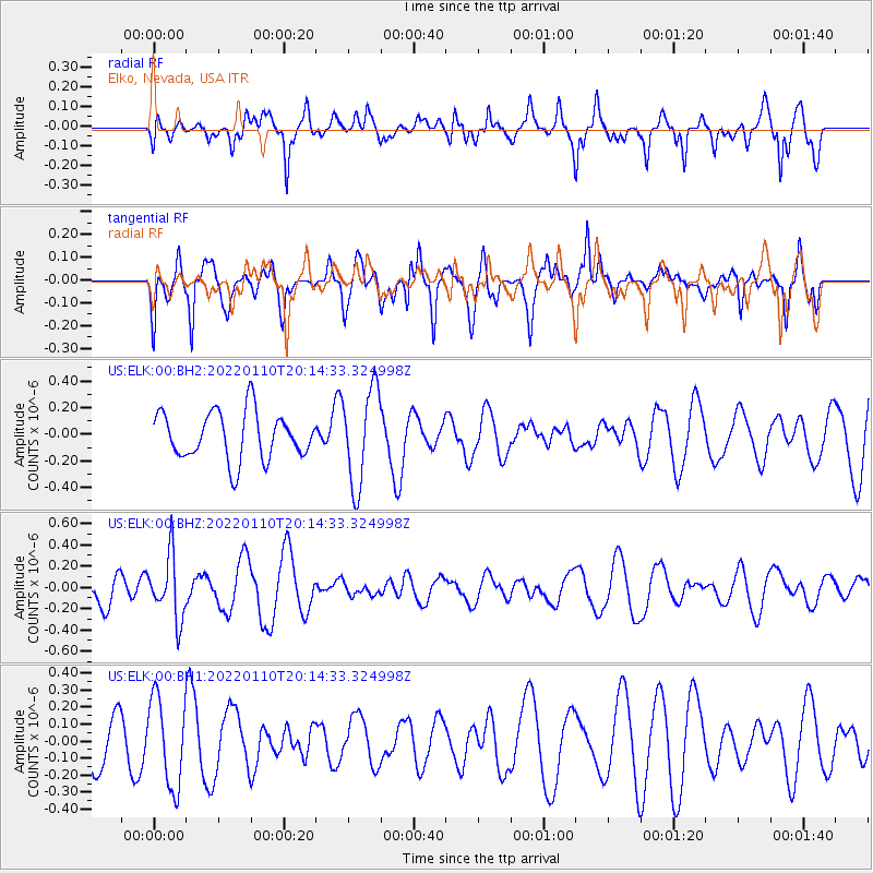
ELK Elko, Nevada, USA - Earthquake Result Viewer
*The percent match for this event was below the threshold and hence no stack was calculated.
| Earthquake location: |
South Of Fiji Islands |
| Earthquake latitude/longitude: |
-25.0/179.9 |
| Earthquake time(UTC): |
2022/01/10 (010) 20:03:03 GMT |
| Earthquake Depth: |
489 km |
| Earthquake Magnitude: |
5.7 Mww |
| Earthquake Catalog/Contributor: |
NEIC PDE/us |
|
| Network: |
US United States National Seismic Network |
| Station: |
ELK Elko, Nevada, USA |
| Lat/Lon: |
40.74 N/115.24 W |
| Elevation: |
2210 m |
|
| Distance: |
88.9 deg |
| Az: |
43.474 deg |
| Baz: |
235.253 deg |
| Ray Param: |
$rayparam |
*The percent match for this event was below the threshold and hence was not used in the summary stack. |
|
| Radial Match: |
60.505806 % |
| Radial Bump: |
400 |
| Transverse Match: |
54.431564 % |
| Transverse Bump: |
340 |
| SOD ConfigId: |
26694651 |
| Insert Time: |
2022-01-24 20:20:22.776 +0000 |
| GWidth: |
2.5 |
| Max Bumps: |
400 |
| Tol: |
0.001 |
|
Signal To Noise
| Channel | StoN | STA | LTA |
| US:ELK:00:BHZ:20220110T20:14:33.324998Z | 1.9421948 | 2.9568216E-7 | 1.5224124E-7 |
| US:ELK:00:BH1:20220110T20:14:33.324998Z | 1.7474456 | 2.6137388E-7 | 1.4957484E-7 |
| US:ELK:00:BH2:20220110T20:14:33.324998Z | 2.027445 | 3.6133633E-7 | 1.7822249E-7 |
| Arrivals |
| Ps | |
| PpPs | |
| PsPs/PpSs | |


