TUML YL.TUML - Earthquake Result Viewer
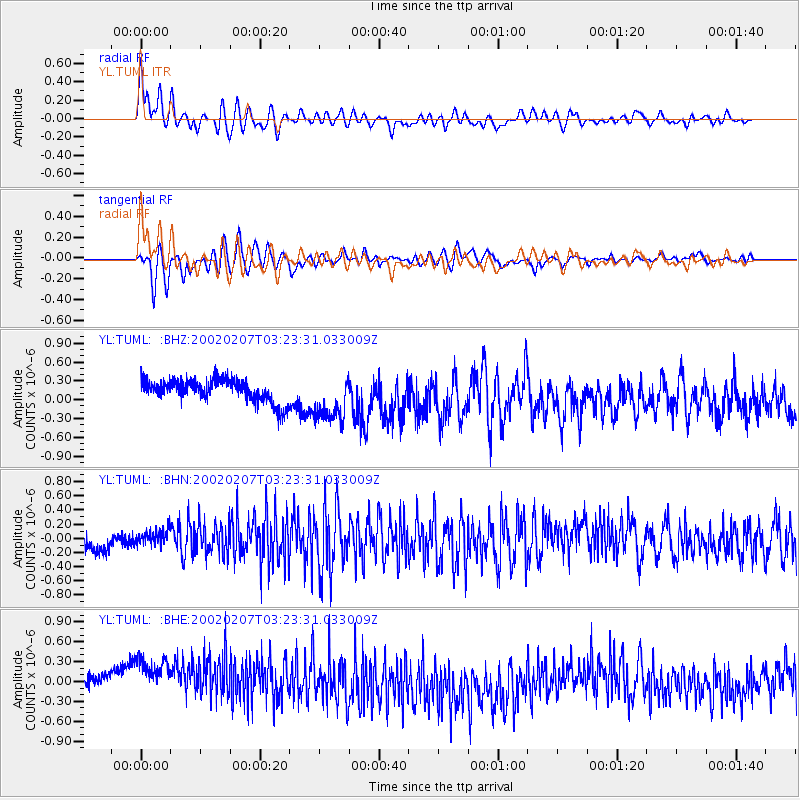
Earthquake location: Talaud Islands, Indonesia
Earthquake latitude/longitude: 3.0/126.3
Earthquake time(UTC): 2002/02/07 (038) 03:15:53 GMT
Earthquake Depth: 33 km
Earthquake Magnitude: 5.5 MB, 5.4 MS, 5.8 MW, 5.6 MW
Earthquake Catalog/Contributor: WHDF/NEIC
Network: YL Himalayan Nepal Tibet Experiment
Station: TUML YL.TUML
Lat/Lon: 27.32 N/87.19 E
Elevation: 360 m
Distance: 44.5 deg
Az: 306.8 deg
Baz: 116.004 deg
Ray Param: 0.0718275
Estimated Moho Depth: 45.25 km
Estimated Crust Vp/Vs: 1.65
Assumed Crust Vp: 6.236 km/s
Estimated Crust Vs: 3.768 km/s
Estimated Crust Poisson's Ratio: 0.21
Radial Match: 81.197105 %
Radial Bump: 400
Transverse Match: 80.18446 %
Transverse Bump: 400
SOD ConfigId: 16820
Insert Time: 2010-02-26 16:17:47.063 +0000
GWidth: 2.5
Max Bumps: 400
Tol: 0.001

Signal To Noise

ChannelStoNSTALTA
YL:TUML: :BHN:20020207T03:23:31.033009Z0.65093481.0129194E-71.5560997E-7
YL:TUML: :BHE:20020207T03:23:31.033009Z2.81356794.9585196E-71.7623601E-7
YL:TUML: :BHZ:20020207T03:23:31.033009Z2.21727853.9172312E-71.7666844E-7
Arrivals
Ps5.1 SECOND
PpPs18 SECOND
PsPs/PpSs23 SECOND