You are here: Home > Network List > US - United States National Seismic Network Stations List
> Station EGMT Eagleton, Montana, USA > Earthquake Result Viewer
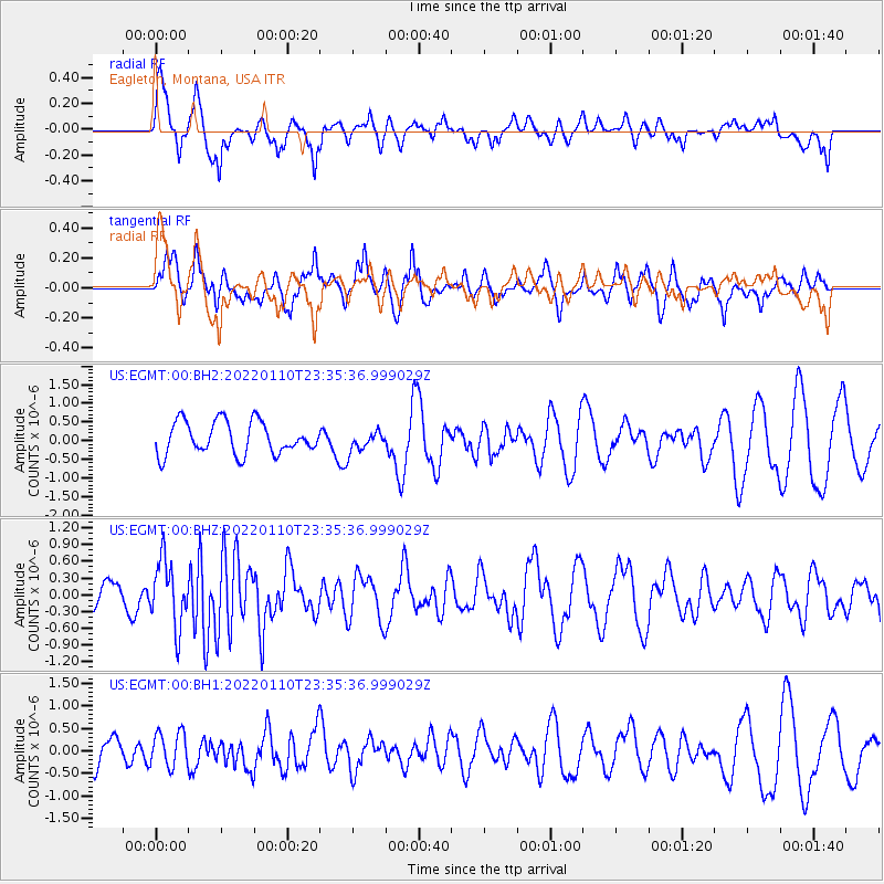
EGMT Eagleton, Montana, USA - Earthquake Result Viewer
*The percent match for this event was below the threshold and hence no stack was calculated.
| Earthquake location: |
Northern Mid-Atlantic Ridge |
| Earthquake latitude/longitude: |
28.5/-43.6 |
| Earthquake time(UTC): |
2022/01/10 (010) 23:26:45 GMT |
| Earthquake Depth: |
10 km |
| Earthquake Magnitude: |
5.8 Mww |
| Earthquake Catalog/Contributor: |
NEIC PDE/us |
|
| Network: |
US United States National Seismic Network |
| Station: |
EGMT Eagleton, Montana, USA |
| Lat/Lon: |
48.02 N/109.75 W |
| Elevation: |
1055 m |
|
| Distance: |
53.8 deg |
| Az: |
310.467 deg |
| Baz: |
86.137 deg |
| Ray Param: |
$rayparam |
*The percent match for this event was below the threshold and hence was not used in the summary stack. |
|
| Radial Match: |
64.20775 % |
| Radial Bump: |
333 |
| Transverse Match: |
58.577053 % |
| Transverse Bump: |
392 |
| SOD ConfigId: |
26694651 |
| Insert Time: |
2022-01-24 23:55:42.430 +0000 |
| GWidth: |
2.5 |
| Max Bumps: |
400 |
| Tol: |
0.001 |
|
Signal To Noise
| Channel | StoN | STA | LTA |
| US:EGMT:00:BHZ:20220110T23:35:36.999029Z | 2.4752095 | 5.845322E-7 | 2.3615462E-7 |
| US:EGMT:00:BH1:20220110T23:35:36.999029Z | 0.86280656 | 3.9099473E-7 | 4.5316614E-7 |
| US:EGMT:00:BH2:20220110T23:35:36.999029Z | 0.6443236 | 2.7852045E-7 | 4.3226794E-7 |
| Arrivals |
| Ps | |
| PpPs | |
| PsPs/PpSs | |


