TUML YL.TUML - Earthquake Result Viewer
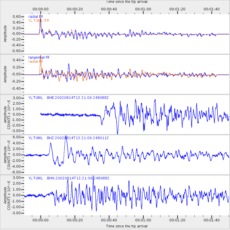
Earthquake location: W. Caroline Islands, Micronesia
Earthquake latitude/longitude: 7.8/136.9
Earthquake time(UTC): 2002/08/14 (226) 13:12:39 GMT
Earthquake Depth: 10 km
Earthquake Magnitude: 6.1 MB, 6.0 MS, 6.3 MW, 6.3 MW
Earthquake Catalog/Contributor: WHDF/NEIC
Network: YL Himalayan Nepal Tibet Experiment
Station: TUML YL.TUML
Lat/Lon: 27.32 N/87.19 E
Elevation: 360 m
Distance: 50.8 deg
Az: 298.895 deg
Baz: 102.843 deg
Ray Param: 0.067817174
Estimated Moho Depth: 38.25 km
Estimated Crust Vp/Vs: 1.80
Assumed Crust Vp: 6.236 km/s
Estimated Crust Vs: 3.464 km/s
Estimated Crust Poisson's Ratio: 0.28
Radial Match: 82.1508 %
Radial Bump: 400
Transverse Match: 68.45907 %
Transverse Bump: 400
SOD ConfigId: 16844
Insert Time: 2010-02-26 16:18:06.846 +0000
GWidth: 2.5
Max Bumps: 400
Tol: 0.001

Signal To Noise

ChannelStoNSTALTA
YL:TUML: :BHZ:20020814T13:21:09.248011Z1.18126391.4366529E-71.2161998E-7
YL:TUML: :BHN:20020814T13:21:09.248988Z1.68601021.528439E-79.065419E-8
YL:TUML: :BHE:20020814T13:21:09.248988Z1.28430941.3644599E-71.06240755E-7
Arrivals
Ps5.2 SECOND
PpPs16 SECOND
PsPs/PpSs21 SECOND