You are here: Home > Network List > UW - Pacific Northwest Regional Seismic Network Stations List
> Station UMAT Pilot Rock, OR, USA > Earthquake Result Viewer
UMAT Pilot Rock, OR, USA - Earthquake Result Viewer
*The percent match for this event was below the threshold and hence no stack was calculated.
| Earthquake location: |
Northern Mid-Atlantic Ridge |
| Earthquake latitude/longitude: |
28.5/-43.6 |
| Earthquake time(UTC): |
2022/01/10 (010) 23:26:45 GMT |
| Earthquake Depth: |
10 km |
| Earthquake Magnitude: |
5.8 Mww |
| Earthquake Catalog/Contributor: |
NEIC PDE/us |
|
| Network: |
UW Pacific Northwest Regional Seismic Network |
| Station: |
UMAT Pilot Rock, OR, USA |
| Lat/Lon: |
45.29 N/118.96 W |
| Elevation: |
1318 m |
|
| Distance: |
60.4 deg |
| Az: |
308.275 deg |
| Baz: |
78.263 deg |
| Ray Param: |
$rayparam |
*The percent match for this event was below the threshold and hence was not used in the summary stack. |
|
| Radial Match: |
53.059494 % |
| Radial Bump: |
316 |
| Transverse Match: |
47.966778 % |
| Transverse Bump: |
400 |
| SOD ConfigId: |
26694651 |
| Insert Time: |
2022-01-24 23:57:46.044 +0000 |
| GWidth: |
2.5 |
| Max Bumps: |
400 |
| Tol: |
0.001 |
|
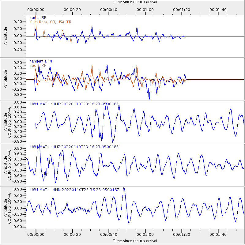
Signal To Noise
| Channel | StoN | STA | LTA |
| UW:UMAT: :HHZ:20220110T23:36:23.950018Z | 2.979323 | 6.810131E-7 | 2.2857981E-7 |
| UW:UMAT: :HHN:20220110T23:36:23.950018Z | 0.4236113 | 1.4295117E-7 | 3.3745832E-7 |
| UW:UMAT: :HHE:20220110T23:36:23.950018Z | 1.5123022 | 3.4137054E-7 | 2.2572905E-7 |
| Arrivals |
| Ps | |
| PpPs | |
| PsPs/PpSs | |


