
TUML YL.TUML - Earthquake Result Viewer
| ||||||||||||||||||
| ||||||||||||||||||
| ||||||||||||||||||
|
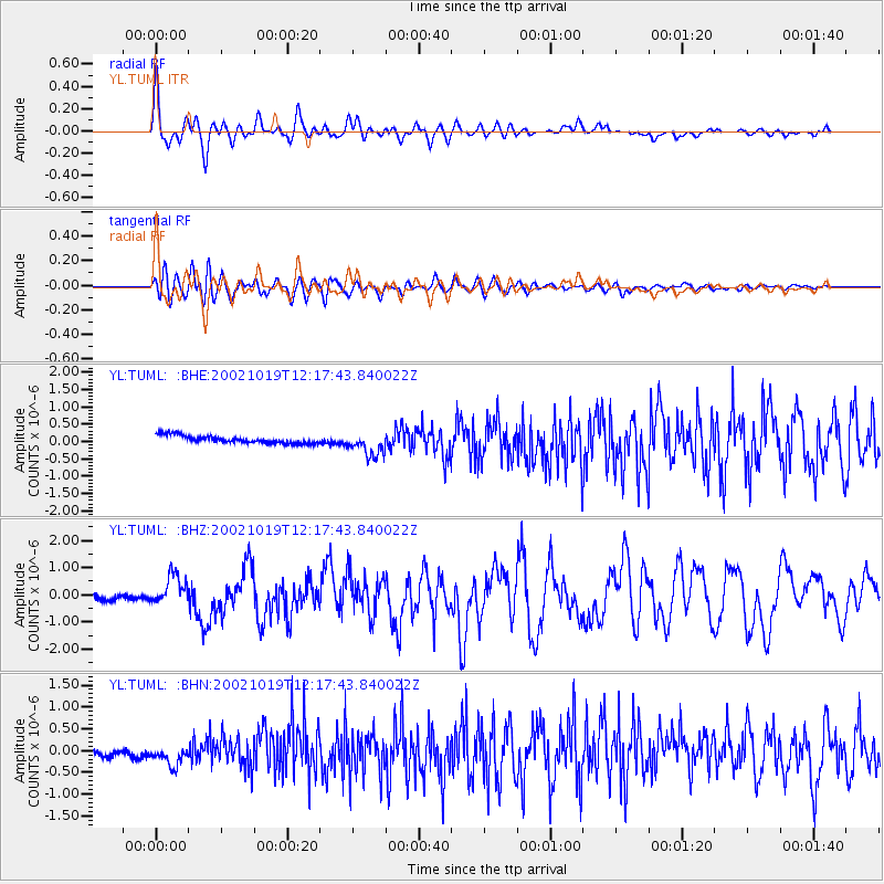
Signal To Noise
| Channel | StoN | STA | LTA |
| YL:TUML: :BHZ:20021019T12:17:43.840022Z | 3.0358768 | 4.956125E-7 | 1.6325184E-7 |
| YL:TUML: :BHN:20021019T12:17:43.840022Z | 1.8538101 | 3.2196093E-7 | 1.7367525E-7 |
| YL:TUML: :BHE:20021019T12:17:43.840022Z | 3.162838 | 3.4952686E-7 | 1.1051052E-7 |
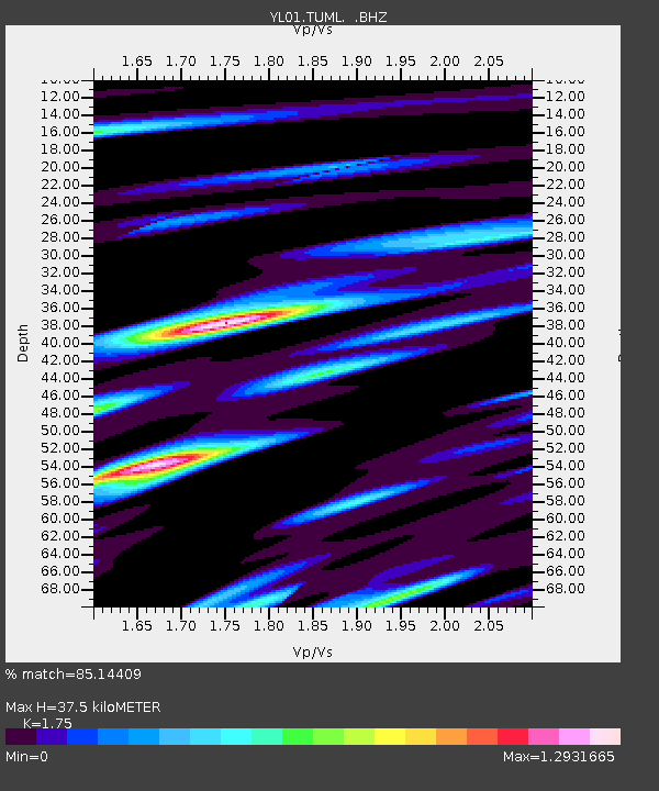
| Arrivals | |
| Ps | 4.8 SECOND |
| PpPs | 16 SECOND |
| PsPs/PpSs | 20 SECOND |

