You are here: Home > Network List > US - United States National Seismic Network Stations List
> Station EGMT Eagleton, Montana, USA > Earthquake Result Viewer
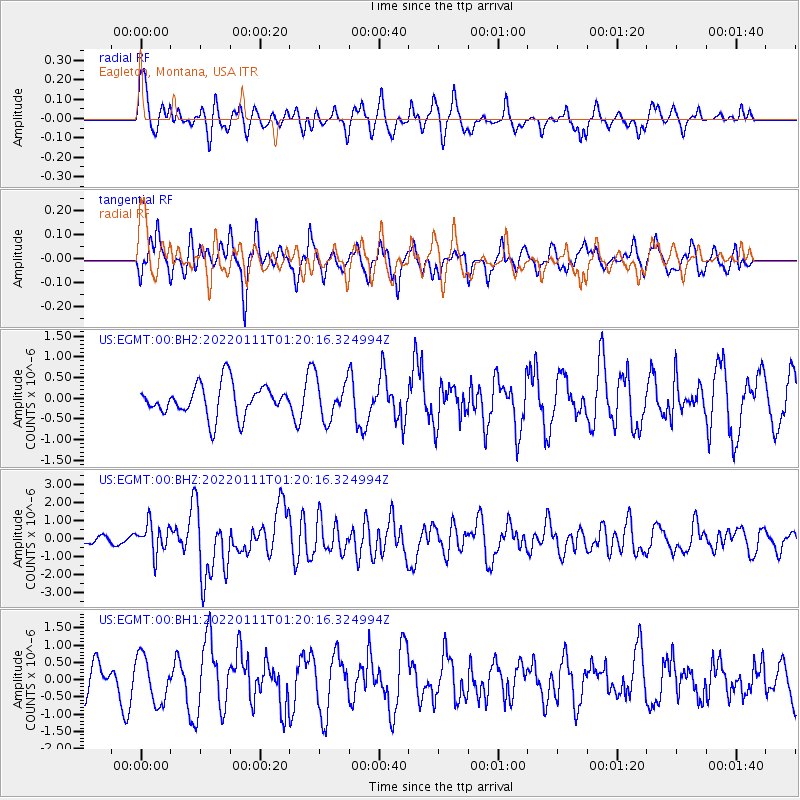
EGMT Eagleton, Montana, USA - Earthquake Result Viewer
*The percent match for this event was below the threshold and hence no stack was calculated.
| Earthquake location: |
Cyprus Region |
| Earthquake latitude/longitude: |
35.1/31.9 |
| Earthquake time(UTC): |
2022/01/11 (011) 01:07:47 GMT |
| Earthquake Depth: |
20 km |
| Earthquake Magnitude: |
6.6 Mww |
| Earthquake Catalog/Contributor: |
NEIC PDE/us |
|
| Network: |
US United States National Seismic Network |
| Station: |
EGMT Eagleton, Montana, USA |
| Lat/Lon: |
48.02 N/109.75 W |
| Elevation: |
1055 m |
|
| Distance: |
90.4 deg |
| Az: |
335.393 deg |
| Baz: |
30.552 deg |
| Ray Param: |
$rayparam |
*The percent match for this event was below the threshold and hence was not used in the summary stack. |
|
| Radial Match: |
56.292713 % |
| Radial Bump: |
400 |
| Transverse Match: |
51.53597 % |
| Transverse Bump: |
397 |
| SOD ConfigId: |
26694651 |
| Insert Time: |
2022-01-25 01:31:29.375 +0000 |
| GWidth: |
2.5 |
| Max Bumps: |
400 |
| Tol: |
0.001 |
|
Signal To Noise
| Channel | StoN | STA | LTA |
| US:EGMT:00:BHZ:20220111T01:20:16.324994Z | 4.1578016 | 8.3229133E-7 | 2.001758E-7 |
| US:EGMT:00:BH1:20220111T01:20:16.324994Z | 1.4171064 | 6.683967E-7 | 4.7166304E-7 |
| US:EGMT:00:BH2:20220111T01:20:16.324994Z | 1.2498491 | 4.776987E-7 | 3.822051E-7 |
| Arrivals |
| Ps | |
| PpPs | |
| PsPs/PpSs | |


