You are here: Home > Network List > US - United States National Seismic Network Stations List
> Station DGMT Dagmar, Montana, USA > Earthquake Result Viewer
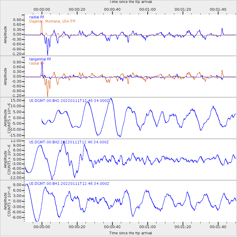
DGMT Dagmar, Montana, USA - Earthquake Result Viewer
*The percent match for this event was below the threshold and hence no stack was calculated.
| Earthquake location: |
Fox Islands, Aleutian Islands |
| Earthquake latitude/longitude: |
52.5/-168.1 |
| Earthquake time(UTC): |
2022/01/11 (011) 12:39:36 GMT |
| Earthquake Depth: |
37 km |
| Earthquake Magnitude: |
6.5 Mi |
| Earthquake Catalog/Contributor: |
NEIC PDE/pt |
|
| Network: |
US United States National Seismic Network |
| Station: |
DGMT Dagmar, Montana, USA |
| Lat/Lon: |
48.47 N/104.20 W |
| Elevation: |
0.0 m |
|
| Distance: |
39.7 deg |
| Az: |
69.414 deg |
| Baz: |
300.694 deg |
| Ray Param: |
$rayparam |
*The percent match for this event was below the threshold and hence was not used in the summary stack. |
|
| Radial Match: |
84.35877 % |
| Radial Bump: |
400 |
| Transverse Match: |
87.67605 % |
| Transverse Bump: |
355 |
| SOD ConfigId: |
26694651 |
| Insert Time: |
2022-01-25 12:59:34.369 +0000 |
| GWidth: |
2.5 |
| Max Bumps: |
400 |
| Tol: |
0.001 |
|
Signal To Noise
| Channel | StoN | STA | LTA |
| US:DGMT:00:BHZ:20220111T12:46:34.000Z | 1.0355256 | 5.7495085E-6 | 5.5522614E-6 |
| US:DGMT:00:BH1:20220111T12:46:34.000Z | 0.80404615 | 5.149246E-6 | 6.4041674E-6 |
| US:DGMT:00:BH2:20220111T12:46:34.000Z | 1.9206228 | 9.902802E-6 | 5.156037E-6 |
| Arrivals |
| Ps | |
| PpPs | |
| PsPs/PpSs | |


