You are here: Home > Network List > US - United States National Seismic Network Stations List
> Station MSO Missoula, Montana, USA > Earthquake Result Viewer
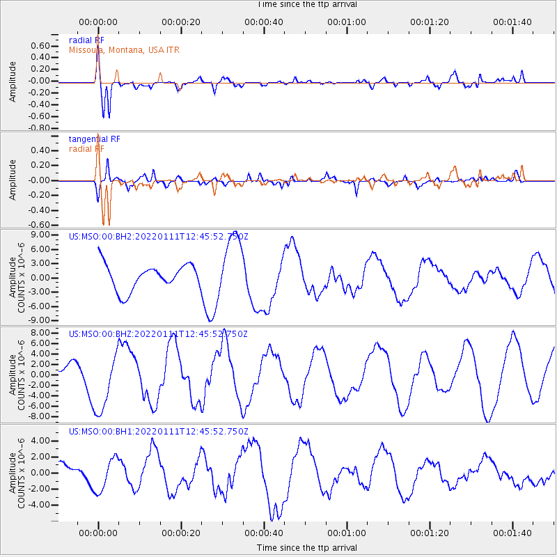
MSO Missoula, Montana, USA - Earthquake Result Viewer
*The percent match for this event was below the threshold and hence no stack was calculated.
| Earthquake location: |
Fox Islands, Aleutian Islands |
| Earthquake latitude/longitude: |
52.5/-168.1 |
| Earthquake time(UTC): |
2022/01/11 (011) 12:39:36 GMT |
| Earthquake Depth: |
37 km |
| Earthquake Magnitude: |
6.5 Mi |
| Earthquake Catalog/Contributor: |
NEIC PDE/pt |
|
| Network: |
US United States National Seismic Network |
| Station: |
MSO Missoula, Montana, USA |
| Lat/Lon: |
46.83 N/113.94 W |
| Elevation: |
1264 m |
|
| Distance: |
34.8 deg |
| Az: |
77.231 deg |
| Baz: |
299.739 deg |
| Ray Param: |
$rayparam |
*The percent match for this event was below the threshold and hence was not used in the summary stack. |
|
| Radial Match: |
61.799355 % |
| Radial Bump: |
400 |
| Transverse Match: |
50.14716 % |
| Transverse Bump: |
400 |
| SOD ConfigId: |
26694651 |
| Insert Time: |
2022-01-25 12:59:51.397 +0000 |
| GWidth: |
2.5 |
| Max Bumps: |
400 |
| Tol: |
0.001 |
|
Signal To Noise
| Channel | StoN | STA | LTA |
| US:MSO:00:BHZ:20220111T12:45:52.750Z | 1.5938652 | 5.9312024E-6 | 3.7212699E-6 |
| US:MSO:00:BH1:20220111T12:45:52.750Z | 1.3376044 | 2.106078E-6 | 1.5745148E-6 |
| US:MSO:00:BH2:20220111T12:45:52.750Z | 2.555609 | 6.7864485E-6 | 2.6555113E-6 |
| Arrivals |
| Ps | |
| PpPs | |
| PsPs/PpSs | |


