You are here: Home > Network List > G - GEOSCOPE Stations List
> Station INU Inuyama, Japan > Earthquake Result Viewer
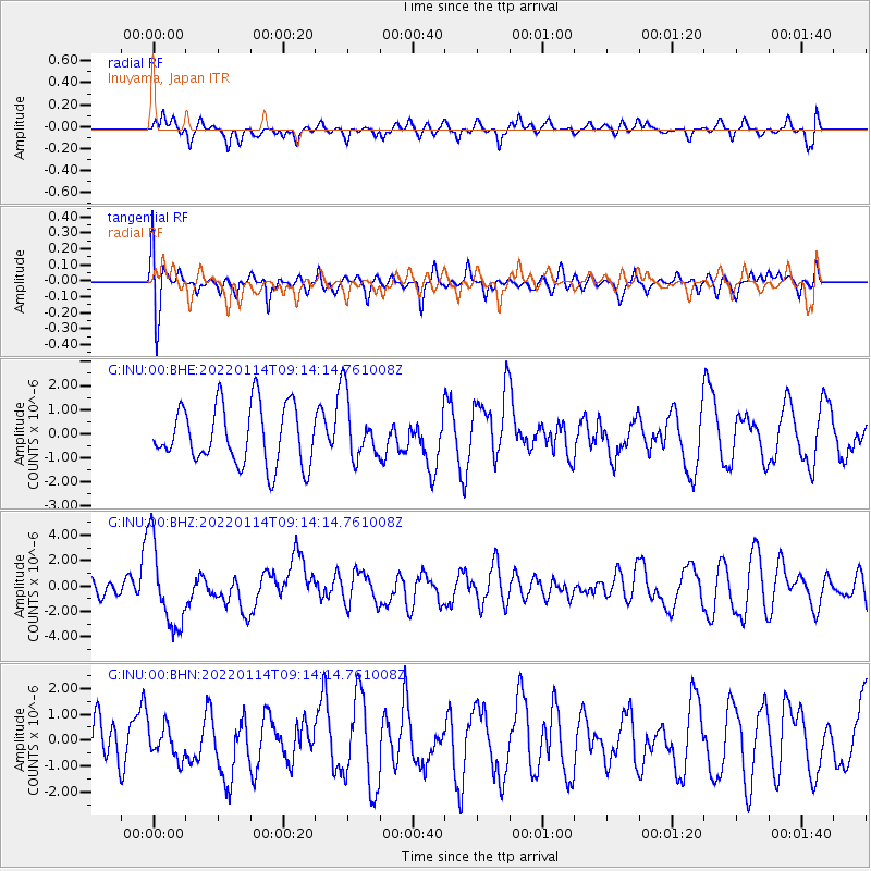
INU Inuyama, Japan - Earthquake Result Viewer
*The percent match for this event was below the threshold and hence no stack was calculated.
| Earthquake location: |
Sunda Strait, Indonesia |
| Earthquake latitude/longitude: |
-6.9/105.3 |
| Earthquake time(UTC): |
2022/01/14 (014) 09:05:42 GMT |
| Earthquake Depth: |
37 km |
| Earthquake Magnitude: |
6.6 mww |
| Earthquake Catalog/Contributor: |
NEIC PDE/us |
|
| Network: |
G GEOSCOPE |
| Station: |
INU Inuyama, Japan |
| Lat/Lon: |
35.35 N/137.03 E |
| Elevation: |
132 m |
|
| Distance: |
51.6 deg |
| Az: |
33.31 deg |
| Baz: |
221.833 deg |
| Ray Param: |
$rayparam |
*The percent match for this event was below the threshold and hence was not used in the summary stack. |
|
| Radial Match: |
51.68124 % |
| Radial Bump: |
400 |
| Transverse Match: |
51.028687 % |
| Transverse Bump: |
400 |
| SOD ConfigId: |
26694651 |
| Insert Time: |
2022-01-28 09:10:53.483 +0000 |
| GWidth: |
2.5 |
| Max Bumps: |
400 |
| Tol: |
0.001 |
|
Signal To Noise
| Channel | StoN | STA | LTA |
| G:INU:00:BHZ:20220114T09:14:14.761008Z | 3.7869618 | 3.3118151E-6 | 8.745309E-7 |
| G:INU:00:BHN:20220114T09:14:14.761008Z | 0.73350644 | 6.089714E-7 | 8.302195E-7 |
| G:INU:00:BHE:20220114T09:14:14.761008Z | 1.0771755 | 1.3053238E-6 | 1.2118023E-6 |
| Arrivals |
| Ps | |
| PpPs | |
| PsPs/PpSs | |


