You are here: Home > Network List > GS - US Geological Survey Networks Stations List
> Station KAN10 Keim Farm > Earthquake Result Viewer
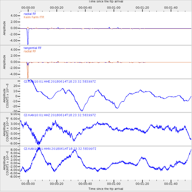
KAN10 Keim Farm - Earthquake Result Viewer
*The percent match for this event was below the threshold and hence no stack was calculated.
| Earthquake location: |
Central Mid-Atlantic Ridge |
| Earthquake latitude/longitude: |
1.1/-25.7 |
| Earthquake time(UTC): |
2018/06/14 (165) 18:12:20 GMT |
| Earthquake Depth: |
10 km |
| Earthquake Magnitude: |
5.6 Mww |
| Earthquake Catalog/Contributor: |
NEIC PDE/us |
|
| Network: |
GS US Geological Survey Networks |
| Station: |
KAN10 Keim Farm |
| Lat/Lon: |
37.12 N/98.10 W |
| Elevation: |
417 m |
|
| Distance: |
75.3 deg |
| Az: |
308.048 deg |
| Baz: |
99.913 deg |
| Ray Param: |
$rayparam |
*The percent match for this event was below the threshold and hence was not used in the summary stack. |
|
| Radial Match: |
97.82439 % |
| Radial Bump: |
73 |
| Transverse Match: |
91.4098 % |
| Transverse Bump: |
181 |
| SOD ConfigId: |
2709371 |
| Insert Time: |
2018-06-28 18:16:15.053 +0000 |
| GWidth: |
2.5 |
| Max Bumps: |
400 |
| Tol: |
0.001 |
|
Signal To Noise
| Channel | StoN | STA | LTA |
| GS:KAN10:01:HHZ:20180614T18:23:32.583997Z | 1.7071472 | 4.445739E-6 | 2.6041916E-6 |
| GS:KAN10:01:HHN:20180614T18:23:32.583997Z | 0.9933228 | 4.2673055E-6 | 4.295991E-6 |
| GS:KAN10:01:HHE:20180614T18:23:32.583997Z | 1.2456845 | 1.3672431E-5 | 1.0975838E-5 |
| Arrivals |
| Ps | |
| PpPs | |
| PsPs/PpSs | |


