You are here: Home > Network List > AK - Alaska Regional Network Stations List
> Station GAMB Gambell Broadband > Earthquake Result Viewer
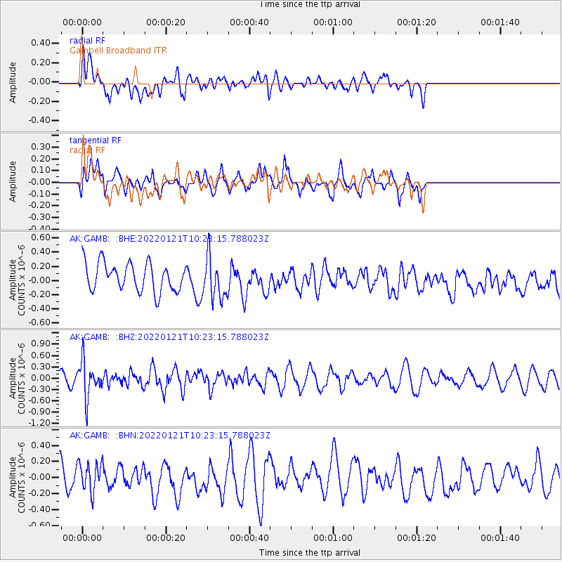
GAMB Gambell Broadband - Earthquake Result Viewer
*The percent match for this event was below the threshold and hence no stack was calculated.
| Earthquake location: |
Myanmar-India Border Region |
| Earthquake latitude/longitude: |
23.1/93.7 |
| Earthquake time(UTC): |
2022/01/21 (021) 10:12:31 GMT |
| Earthquake Depth: |
57 km |
| Earthquake Magnitude: |
5.4 Mww |
| Earthquake Catalog/Contributor: |
NEIC PDE/us |
|
| Network: |
AK Alaska Regional Network |
| Station: |
GAMB Gambell Broadband |
| Lat/Lon: |
63.78 N/171.70 W |
| Elevation: |
10 m |
|
| Distance: |
71.5 deg |
| Az: |
27.831 deg |
| Baz: |
284.576 deg |
| Ray Param: |
$rayparam |
*The percent match for this event was below the threshold and hence was not used in the summary stack. |
|
| Radial Match: |
41.383068 % |
| Radial Bump: |
400 |
| Transverse Match: |
64.0702 % |
| Transverse Bump: |
400 |
| SOD ConfigId: |
26694651 |
| Insert Time: |
2022-02-04 10:14:38.479 +0000 |
| GWidth: |
2.5 |
| Max Bumps: |
400 |
| Tol: |
0.001 |
|
Signal To Noise
| Channel | StoN | STA | LTA |
| AK:GAMB: :BHZ:20220121T10:23:15.788023Z | 2.3903365 | 4.946809E-7 | 2.069503E-7 |
| AK:GAMB: :BHN:20220121T10:23:15.788023Z | 0.90299 | 1.7906395E-7 | 1.9830115E-7 |
| AK:GAMB: :BHE:20220121T10:23:15.788023Z | 1.5010555 | 2.9714496E-7 | 1.9795733E-7 |
| Arrivals |
| Ps | |
| PpPs | |
| PsPs/PpSs | |


