You are here: Home > Network List > UU - University of Utah Regional Network Stations List
> Station FORU South Mineral Mountains, UT, USA > Earthquake Result Viewer
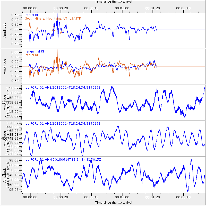
FORU South Mineral Mountains, UT, USA - Earthquake Result Viewer
*The percent match for this event was below the threshold and hence no stack was calculated.
| Earthquake location: |
Central Mid-Atlantic Ridge |
| Earthquake latitude/longitude: |
1.1/-25.7 |
| Earthquake time(UTC): |
2018/06/14 (165) 18:12:20 GMT |
| Earthquake Depth: |
10 km |
| Earthquake Magnitude: |
5.6 Mww |
| Earthquake Catalog/Contributor: |
NEIC PDE/us |
|
| Network: |
UU University of Utah Regional Network |
| Station: |
FORU South Mineral Mountains, UT, USA |
| Lat/Lon: |
38.46 N/112.86 W |
| Elevation: |
1840 m |
|
| Distance: |
87.1 deg |
| Az: |
308.267 deg |
| Baz: |
90.904 deg |
| Ray Param: |
$rayparam |
*The percent match for this event was below the threshold and hence was not used in the summary stack. |
|
| Radial Match: |
65.820015 % |
| Radial Bump: |
400 |
| Transverse Match: |
46.091606 % |
| Transverse Bump: |
373 |
| SOD ConfigId: |
2709371 |
| Insert Time: |
2018-06-28 18:20:48.161 +0000 |
| GWidth: |
2.5 |
| Max Bumps: |
400 |
| Tol: |
0.001 |
|
Signal To Noise
| Channel | StoN | STA | LTA |
| UU:FORU:01:HHZ:20180614T18:24:34.815015Z | 3.303312 | 7.829107E-9 | 2.370078E-9 |
| UU:FORU:01:HHN:20180614T18:24:34.815015Z | 1.034797 | 3.3767957E-9 | 3.2632448E-9 |
| UU:FORU:01:HHE:20180614T18:24:34.815015Z | 1.1668367 | 5.7272707E-9 | 4.9083737E-9 |
| Arrivals |
| Ps | |
| PpPs | |
| PsPs/PpSs | |


