You are here: Home > Network List > CN - Canadian National Seismograph Network Stations List
> Station INK INUVIK, NT > Earthquake Result Viewer
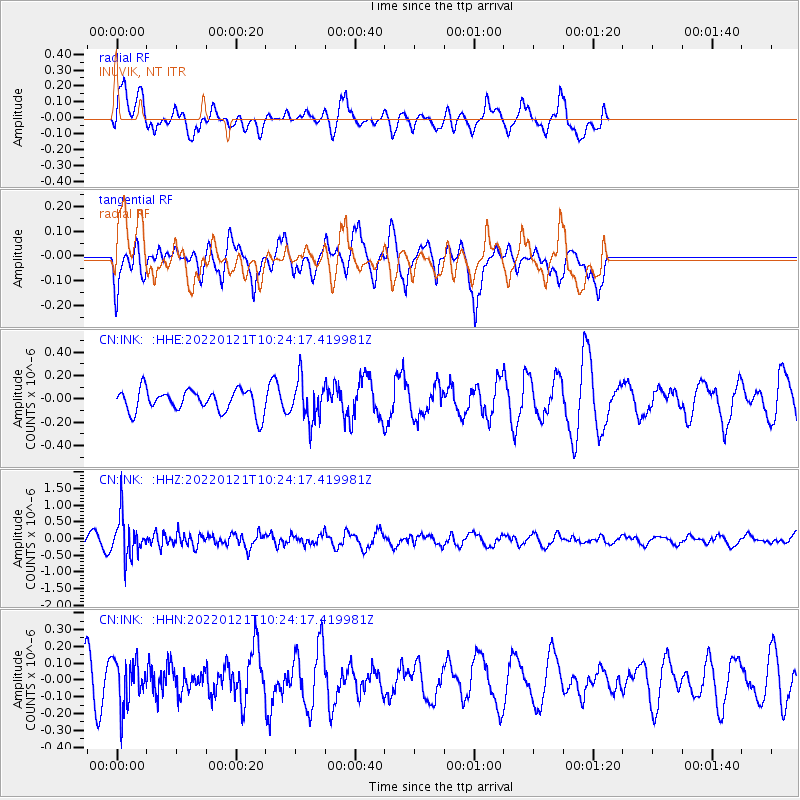
INK INUVIK, NT - Earthquake Result Viewer
*The percent match for this event was below the threshold and hence no stack was calculated.
| Earthquake location: |
Myanmar-India Border Region |
| Earthquake latitude/longitude: |
23.1/93.7 |
| Earthquake time(UTC): |
2022/01/21 (021) 10:12:31 GMT |
| Earthquake Depth: |
57 km |
| Earthquake Magnitude: |
5.4 Mww |
| Earthquake Catalog/Contributor: |
NEIC PDE/us |
|
| Network: |
CN Canadian National Seismograph Network |
| Station: |
INK INUVIK, NT |
| Lat/Lon: |
68.31 N/133.53 W |
| Elevation: |
44 m |
|
| Distance: |
82.6 deg |
| Az: |
15.985 deg |
| Baz: |
316.987 deg |
| Ray Param: |
$rayparam |
*The percent match for this event was below the threshold and hence was not used in the summary stack. |
|
| Radial Match: |
70.08253 % |
| Radial Bump: |
400 |
| Transverse Match: |
69.286606 % |
| Transverse Bump: |
374 |
| SOD ConfigId: |
26694651 |
| Insert Time: |
2022-02-04 10:20:02.440 +0000 |
| GWidth: |
2.5 |
| Max Bumps: |
400 |
| Tol: |
0.001 |
|
Signal To Noise
| Channel | StoN | STA | LTA |
| CN:INK: :HHZ:20220121T10:24:17.419981Z | 3.6848178 | 5.8177375E-7 | 1.57884E-7 |
| CN:INK: :HHN:20220121T10:24:17.419981Z | 1.0207729 | 1.3592448E-7 | 1.3315838E-7 |
| CN:INK: :HHE:20220121T10:24:17.419981Z | 1.7798188 | 1.7141087E-7 | 9.630805E-8 |
| Arrivals |
| Ps | |
| PpPs | |
| PsPs/PpSs | |


