You are here: Home > Network List > IW - Intermountain West Stations List
> Station MOOW Moose Ponds, Wyoming, USA > Earthquake Result Viewer
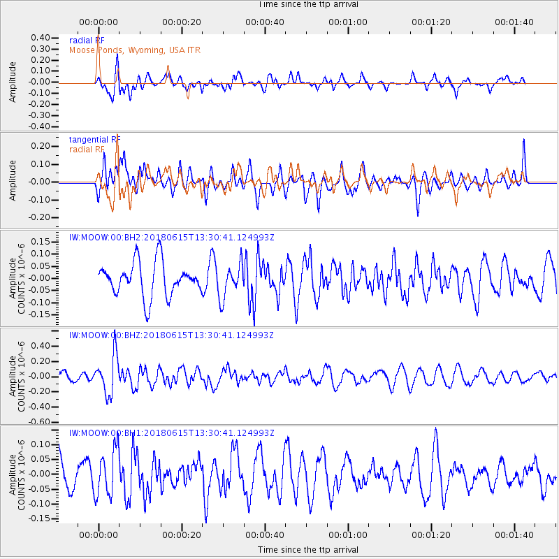
MOOW Moose Ponds, Wyoming, USA - Earthquake Result Viewer
*The percent match for this event was below the threshold and hence no stack was calculated.
| Earthquake location: |
Tonga Islands |
| Earthquake latitude/longitude: |
-15.4/-173.0 |
| Earthquake time(UTC): |
2018/06/15 (166) 13:18:53 GMT |
| Earthquake Depth: |
10 km |
| Earthquake Magnitude: |
5.6 mb |
| Earthquake Catalog/Contributor: |
NEIC PDE/us |
|
| Network: |
IW Intermountain West |
| Station: |
MOOW Moose Ponds, Wyoming, USA |
| Lat/Lon: |
43.75 N/110.74 W |
| Elevation: |
2128 m |
|
| Distance: |
81.7 deg |
| Az: |
40.399 deg |
| Baz: |
239.613 deg |
| Ray Param: |
$rayparam |
*The percent match for this event was below the threshold and hence was not used in the summary stack. |
|
| Radial Match: |
45.63759 % |
| Radial Bump: |
400 |
| Transverse Match: |
53.66768 % |
| Transverse Bump: |
400 |
| SOD ConfigId: |
2709371 |
| Insert Time: |
2018-06-29 13:22:14.859 +0000 |
| GWidth: |
2.5 |
| Max Bumps: |
400 |
| Tol: |
0.001 |
|
Signal To Noise
| Channel | StoN | STA | LTA |
| IW:MOOW:00:BHZ:20180615T13:30:41.124993Z | 5.088897 | 2.6155004E-7 | 5.139621E-8 |
| IW:MOOW:00:BH1:20180615T13:30:41.124993Z | 1.3043578 | 7.955373E-8 | 6.099073E-8 |
| IW:MOOW:00:BH2:20180615T13:30:41.124993Z | 1.0039413 | 6.981142E-8 | 6.953736E-8 |
| Arrivals |
| Ps | |
| PpPs | |
| PsPs/PpSs | |


