You are here: Home > Network List > US - United States National Seismic Network Stations List
> Station BOZ Bozeman, Montana, USA > Earthquake Result Viewer
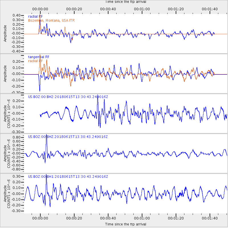
BOZ Bozeman, Montana, USA - Earthquake Result Viewer
*The percent match for this event was below the threshold and hence no stack was calculated.
| Earthquake location: |
Tonga Islands |
| Earthquake latitude/longitude: |
-15.4/-173.0 |
| Earthquake time(UTC): |
2018/06/15 (166) 13:18:53 GMT |
| Earthquake Depth: |
10 km |
| Earthquake Magnitude: |
5.6 mb |
| Earthquake Catalog/Contributor: |
NEIC PDE/us |
|
| Network: |
US United States National Seismic Network |
| Station: |
BOZ Bozeman, Montana, USA |
| Lat/Lon: |
45.65 N/111.63 W |
| Elevation: |
1589 m |
|
| Distance: |
82.2 deg |
| Az: |
38.427 deg |
| Baz: |
238.717 deg |
| Ray Param: |
$rayparam |
*The percent match for this event was below the threshold and hence was not used in the summary stack. |
|
| Radial Match: |
54.956184 % |
| Radial Bump: |
400 |
| Transverse Match: |
48.8815 % |
| Transverse Bump: |
396 |
| SOD ConfigId: |
2709371 |
| Insert Time: |
2018-06-29 13:24:28.983 +0000 |
| GWidth: |
2.5 |
| Max Bumps: |
400 |
| Tol: |
0.001 |
|
Signal To Noise
| Channel | StoN | STA | LTA |
| US:BOZ:00:BHZ:20180615T13:30:43.249016Z | 3.4758034 | 3.1882067E-7 | 9.172575E-8 |
| US:BOZ:00:BH1:20180615T13:30:43.249016Z | 1.7904859 | 1.1168138E-7 | 6.23749E-8 |
| US:BOZ:00:BH2:20180615T13:30:43.249016Z | 1.6640242 | 9.597254E-8 | 5.7674963E-8 |
| Arrivals |
| Ps | |
| PpPs | |
| PsPs/PpSs | |


