You are here: Home > Network List > US - United States National Seismic Network Stations List
> Station HAWA Hanford, Washington, USA > Earthquake Result Viewer
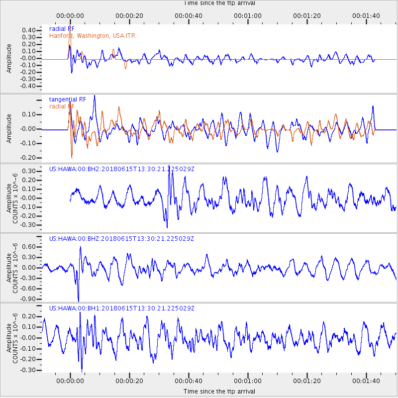
HAWA Hanford, Washington, USA - Earthquake Result Viewer
*The percent match for this event was below the threshold and hence no stack was calculated.
| Earthquake location: |
Tonga Islands |
| Earthquake latitude/longitude: |
-15.4/-173.0 |
| Earthquake time(UTC): |
2018/06/15 (166) 13:18:53 GMT |
| Earthquake Depth: |
10 km |
| Earthquake Magnitude: |
5.6 mb |
| Earthquake Catalog/Contributor: |
NEIC PDE/us |
|
| Network: |
US United States National Seismic Network |
| Station: |
HAWA Hanford, Washington, USA |
| Lat/Lon: |
46.39 N/119.53 W |
| Elevation: |
364 m |
|
| Distance: |
78.1 deg |
| Az: |
34.644 deg |
| Baz: |
232.394 deg |
| Ray Param: |
$rayparam |
*The percent match for this event was below the threshold and hence was not used in the summary stack. |
|
| Radial Match: |
56.112976 % |
| Radial Bump: |
400 |
| Transverse Match: |
52.979046 % |
| Transverse Bump: |
400 |
| SOD ConfigId: |
2709371 |
| Insert Time: |
2018-06-29 13:24:47.148 +0000 |
| GWidth: |
2.5 |
| Max Bumps: |
400 |
| Tol: |
0.001 |
|
Signal To Noise
| Channel | StoN | STA | LTA |
| US:HAWA:00:BHZ:20180615T13:30:21.225029Z | 4.5581036 | 3.1894385E-7 | 6.997293E-8 |
| US:HAWA:00:BH1:20180615T13:30:21.225029Z | 1.127418 | 1.0989167E-7 | 9.747199E-8 |
| US:HAWA:00:BH2:20180615T13:30:21.225029Z | 2.7199857 | 1.7303846E-7 | 6.3617414E-8 |
| Arrivals |
| Ps | |
| PpPs | |
| PsPs/PpSs | |


