You are here: Home > Network List > US - United States National Seismic Network Stations List
> Station LAO LASA Array, Montana, USA > Earthquake Result Viewer
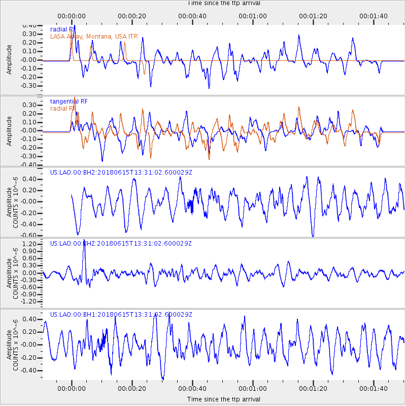
LAO LASA Array, Montana, USA - Earthquake Result Viewer
*The percent match for this event was below the threshold and hence no stack was calculated.
| Earthquake location: |
Tonga Islands |
| Earthquake latitude/longitude: |
-15.4/-173.0 |
| Earthquake time(UTC): |
2018/06/15 (166) 13:18:53 GMT |
| Earthquake Depth: |
10 km |
| Earthquake Magnitude: |
5.6 mb |
| Earthquake Catalog/Contributor: |
NEIC PDE/us |
|
| Network: |
US United States National Seismic Network |
| Station: |
LAO LASA Array, Montana, USA |
| Lat/Lon: |
46.69 N/106.22 W |
| Elevation: |
902 m |
|
| Distance: |
86.0 deg |
| Az: |
39.362 deg |
| Baz: |
242.703 deg |
| Ray Param: |
$rayparam |
*The percent match for this event was below the threshold and hence was not used in the summary stack. |
|
| Radial Match: |
65.762405 % |
| Radial Bump: |
365 |
| Transverse Match: |
49.70833 % |
| Transverse Bump: |
400 |
| SOD ConfigId: |
2709371 |
| Insert Time: |
2018-06-29 13:24:59.829 +0000 |
| GWidth: |
2.5 |
| Max Bumps: |
400 |
| Tol: |
0.001 |
|
Signal To Noise
| Channel | StoN | STA | LTA |
| US:LAO:00:BHZ:20180615T13:31:02.600029Z | 5.083217 | 4.938435E-7 | 9.715176E-8 |
| US:LAO:00:BH1:20180615T13:31:02.600029Z | 0.91546863 | 1.7161318E-7 | 1.8745938E-7 |
| US:LAO:00:BH2:20180615T13:31:02.600029Z | 0.71776116 | 1.7265741E-7 | 2.4054995E-7 |
| Arrivals |
| Ps | |
| PpPs | |
| PsPs/PpSs | |


