You are here: Home > Network List > US - United States National Seismic Network Stations List
> Station EGMT Eagleton, Montana, USA > Earthquake Result Viewer
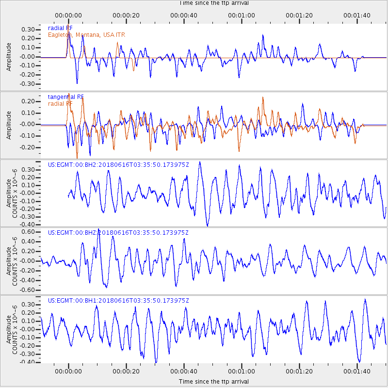
EGMT Eagleton, Montana, USA - Earthquake Result Viewer
*The percent match for this event was below the threshold and hence no stack was calculated.
| Earthquake location: |
Fiji Islands Region |
| Earthquake latitude/longitude: |
-16.2/-177.6 |
| Earthquake time(UTC): |
2018/06/16 (167) 03:23:32 GMT |
| Earthquake Depth: |
10 km |
| Earthquake Magnitude: |
5.5 mb |
| Earthquake Catalog/Contributor: |
NEIC PDE/us |
|
| Network: |
US United States National Seismic Network |
| Station: |
EGMT Eagleton, Montana, USA |
| Lat/Lon: |
48.02 N/109.75 W |
| Elevation: |
1055 m |
|
| Distance: |
87.9 deg |
| Az: |
38.477 deg |
| Baz: |
242.911 deg |
| Ray Param: |
$rayparam |
*The percent match for this event was below the threshold and hence was not used in the summary stack. |
|
| Radial Match: |
72.19024 % |
| Radial Bump: |
400 |
| Transverse Match: |
51.133934 % |
| Transverse Bump: |
400 |
| SOD ConfigId: |
2709371 |
| Insert Time: |
2018-06-30 03:30:30.731 +0000 |
| GWidth: |
2.5 |
| Max Bumps: |
400 |
| Tol: |
0.001 |
|
Signal To Noise
| Channel | StoN | STA | LTA |
| US:EGMT:00:BHZ:20180616T03:35:50.173975Z | 1.8077662 | 1.6005647E-7 | 8.8538265E-8 |
| US:EGMT:00:BH1:20180616T03:35:50.173975Z | 0.7325395 | 8.044108E-8 | 1.0981127E-7 |
| US:EGMT:00:BH2:20180616T03:35:50.173975Z | 0.5641484 | 7.250719E-8 | 1.2852502E-7 |
| Arrivals |
| Ps | |
| PpPs | |
| PsPs/PpSs | |


